Your Guide to Blank North America Maps
Discover versatile blank North America maps for education, business, and creative projects. Find high-quality, printable, and customizable map resources.
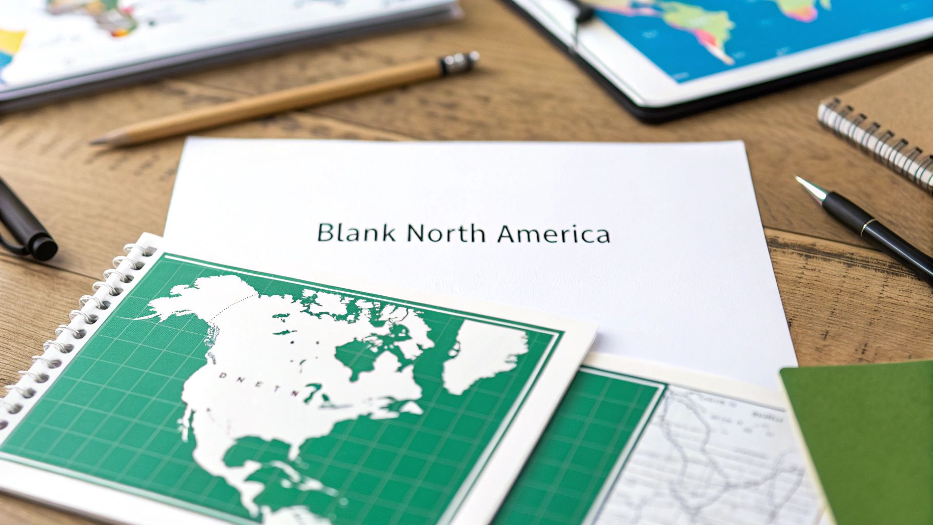
A blank North America map is an incredibly versatile tool. Think of it as a clean slate for education, planning, and all sorts of creative projects. It gives you the pure outline of the continent, free from labels and other noise, making it the perfect starting point for just about anything.
Whether you're building a quiz for a classroom, mapping out an epic travel itinerary, or doing some strategic business analysis, a blank map is where you begin.
Your Essential Toolkit for North America Maps
Picture a blank North America map as an empty canvas. For a history student, it's a space to trace ancient migration routes. For a road-tripper, it’s the blueprint for the adventure of a lifetime. The real power of this simple tool is that it strips away all the pre-filled information, inviting you to add your own layer of knowledge and context. It’s not just a passive reference—it becomes an active, hands-on learning aid.
These maps aren't just for geography buffs, either. They're practical instruments for a huge range of tasks. You might use one to plot out sales territories, track wildlife habitats, or simply teach a child where Canada, the United States, and Mexico are. Their strength is in their simplicity. They let you focus entirely on the geographical shapes and relationships that matter for your specific project.
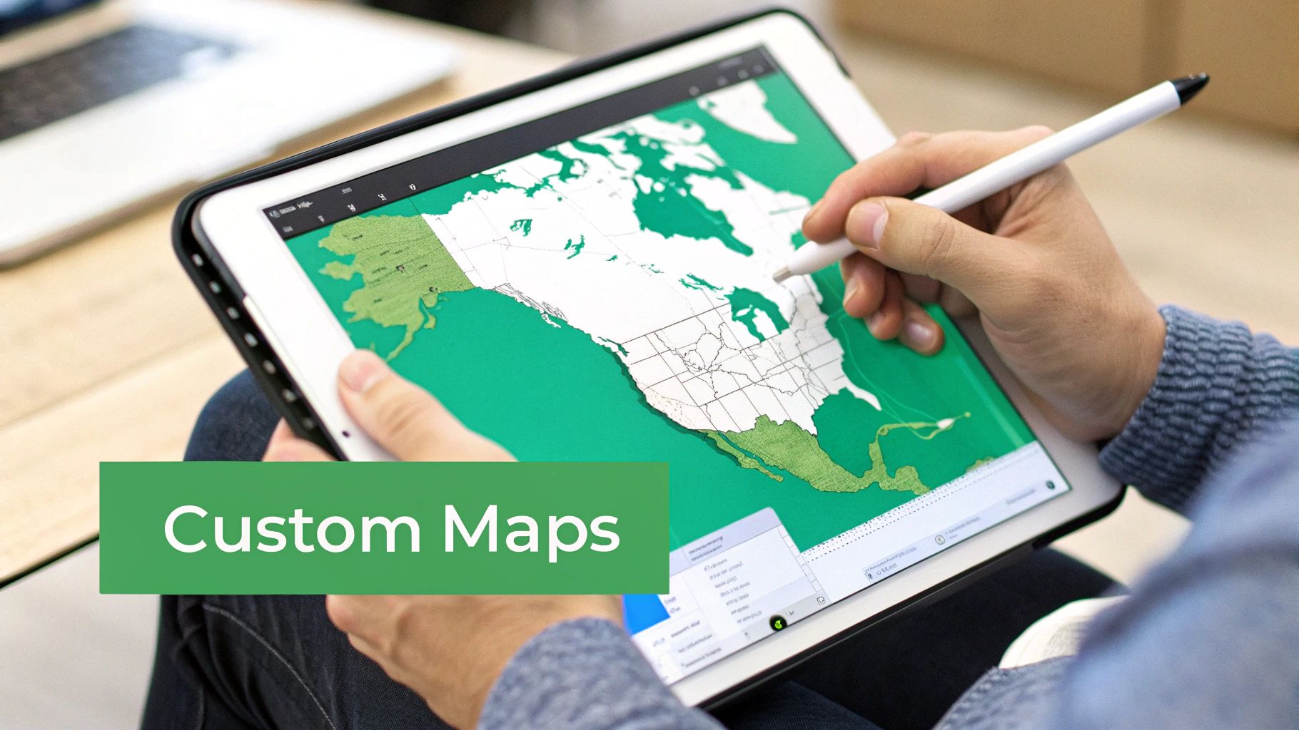
Once you start customizing your maps, you'll want an easy way to share and print them. A great tool for this is something that can easily convert your map images to PDF. This little step makes distributing your custom creations a whole lot simpler, especially if you're working with different image formats.
Which Blank North America Map Do You Need?
Choosing the right map comes down to what you’re trying to do. Are you teaching the broad outlines of the countries, or do you need to get into the nitty-gritty of state and provincial boundaries?
This quick comparison should help you figure out which map type is the best fit for your project.
| Map Type | Key Features | Best For | Example Use Case |
|---|---|---|---|
| Simple Outline | Just the continent's external border. | Creative projects, art, basic continent identification. | An elementary student coloring the landmass of North America. |
| Political Outline | Shows country borders (USA, Canada, Mexico). | Learning national geography, high-level planning. | A student labeling the three major countries of the continent. |
| Detailed Political | Includes states, provinces, and territories. | In-depth learning, regional planning, quizzes. | Mapping a cross-country road trip through different states. |
| Physical Outline | Shows major rivers, lakes, and mountain ranges. | Studying natural geography and environmental science. | Shading in the Rocky Mountains or tracing the Mississippi River. |
Each map serves a different purpose, so picking the right one from the start will make your project, whether it's for the classroom or your own exploration, much more effective.
Choosing the Right Map for Your Project
Not all blank maps are built the same—picking the right one is like choosing the perfect tool for a job. Your project's goal is what really matters. Are you making a classroom quiz, a business plan, or just getting creative? That answer will point you to the right map.
The first big decision usually comes down to a political versus a physical map. A political map is all about human-made boundaries. Think country lines, state borders, and provincial divides. It's your go-to when you're working on projects related to government, demographics, or travel routes.
On the other hand, a physical map zeroes in on the natural lay of the land. It shows you the towering mountain ranges, the winding rivers, and the massive lakes, completely ignoring those political lines. This type is perfect if you're studying geology, tracking weather patterns, or exploring ecological topics.
The Major Map Categories
To make the best choice, think about what information you absolutely need to show. Each map type offers a different kind of canvas for your ideas.
- Outline Maps: This is your map in its purest form, often showing just the continent's coastline. It’s a true blank slate, perfect for high-level geography quizzes or artistic projects where you want total creative freedom.
- Political Maps: These maps show the borders of the United States, Canada, and Mexico. If you need more detail, you can find versions that also include states and provinces, which is a must-have for any project that needs that regional breakdown. For a wider view, our guide on the blank map of the Americas gives you a great continental perspective.
- Physical Maps: These are fantastic for getting a feel for the continent's terrain. If your goal is to trace the path of the Mississippi River or shade in the Rocky Mountains, a physical outline is the only way to go.
This diagram helps visualize how these different map types serve their own unique purpose, whether it's for learning, planning, or creating.
As you can see, a simple blank map can be a powerful tool for education, a framework for a big project, or a canvas for your next masterpiece.
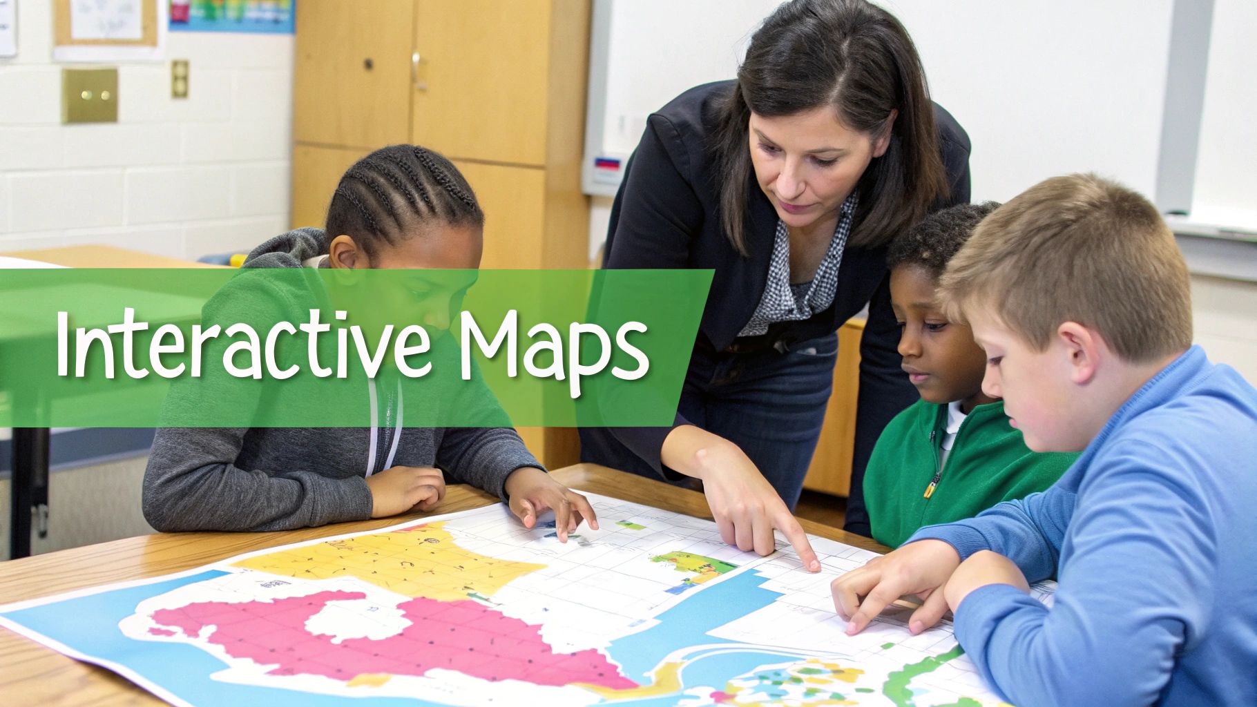
Transforming Education with Interactive Maps
Blank maps are a secret weapon in the classroom, turning abstract lines and names into something kids can actually touch and interact with. Instead of just reading about history or geography, students get to be part of it. A simple blank North America map becomes a canvas for storytelling and discovery.
This hands-on approach is where the real learning sticks. It helps build spatial awareness and critical thinking in a way that just staring at a textbook never could.
Imagine a student tracing the rugged path of the Lewis and Clark expedition or shading in the territories gained during westward expansion. These simple actions create a much deeper, more memorable connection to the material. A kid who physically colors in climate zones or draws the migration routes of monarch butterflies is going to remember that information far longer.
Classroom Activities That Inspire
Turning a map into an exciting lesson is easier than you might think. The trick is to connect the map to a story or a clear learning goal. Here are a few practical ideas to bring geography to life:
- Historical Event Mapping: Have students plot key locations from historical events, like battles during the American Revolution or stops along the Underground Railroad.
- Personalized Atlases: Let students create their own atlases by labeling countries, major cities, and huge physical features like the Rocky Mountains or the Great Lakes.
- Cultural and Resource Maps: Ask students to research and illustrate where different natural resources are found or where various indigenous cultures historically lived.
These activities aren't just about memorizing places on a map. They're about understanding the why—how geography shaped history, influenced trade, and guided settlement across the continent. For younger learners, you can start with the basics; our printable states and capitals map is a fantastic resource for building that foundational U.S. knowledge.
A blank map gives students the power to be creators, not just consumers, of information. When they draw, label, and analyze, they are building a mental framework of the world that lasts a lifetime.
Beyond Traditional Geography
The use for blank maps goes way beyond a typical geography class. In a literature lesson, students could map out the journey of characters from a novel that spans North America. In a science class, they could track hurricane paths or plot biodiversity hotspots.
Each activity turns the map from a static piece of paper into a dynamic learning workspace. It sparks curiosity, encourages exploration, and makes learning not only more effective but genuinely fun.
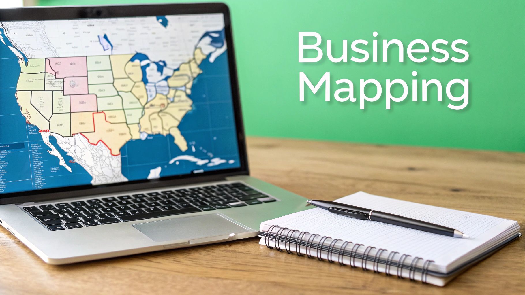
Putting Blank Maps to Work Professionally
That humble blank map you used in school? In the professional world, it gets a serious promotion. It transforms from a simple learning aid into a powerful strategic tool. Businesses, especially, have discovered immense value in using a blank North America map as a canvas to visualize data, plot growth, and fine-tune their operations.
Think of it as cutting through the digital noise. A blank map gives you a clean, clear geographical context for making mission-critical decisions. A national sales manager, for instance, can sketch out sales territories with a political map, making sure the distribution is fair and no two reps are chasing the same leads. Marketing teams can drop pins on the map to see where their customers are, instantly revealing regional hotspots and untapped opportunities. The map becomes a living, breathing dashboard of the company's footprint.
Strategic Business Applications
The applications go way beyond just sales and marketing. For logistics coordinators, blank maps are absolutely essential. Imagine tracing shipping routes from a factory in Mexico, across the United States, and up into Canada. Seeing the entire journey laid out visually helps you spot potential bottlenecks and streamline a supply chain in a way a spreadsheet never could.
Other pros are using them, too:
- Market Analysis: Shading regions based on demographic data or competitor density to pinpoint the perfect spot for expansion.
- Infrastructure Planning: Utility companies and city planners use maps to chart the course for everything from new pipelines to fiber optic networks.
- Event Management: Organizers map out venues, shuttle routes, and hotel clusters for massive conferences and music festivals.
Just as an architect needs a blueprint, a business strategist needs a map. It provides the foundational structure upon which complex plans are built, turning abstract data into actionable geographic intelligence.
A Canvas for Creatives and Hobbyists
But the map's usefulness doesn't stop at the boardroom door. For creators, writers, and hobbyists, a blank map is a framework for imagination. An author writing the next great American road trip novel can use one to make sure their characters' journey is actually plausible, marking key plot points and tracking travel times.
A visual artist might take the continent's outline and turn it into something entirely new, weaving in regional patterns or natural textures. And, of course, travelers and adventurers have been doing this for ages—meticulously planning their trips, highlighting national parks, quirky roadside attractions, and overnight stops.
In every case, the map becomes more than just a tool. It’s the starting point for a story, a plan, or a piece of art—a personalized artifact that’s both a practical guide and a treasured memento of an adventure.
Finding and Customizing High-Quality Maps
A great project always starts with a great map. Finding the right blank North America map is a lot like choosing the perfect canvas for a painting—the quality of your starting material truly defines the final result. Luckily, you don't need to be a professional cartographer to find excellent, printable maps.
Plenty of resources are available online, from educational websites to extensive government archives. These places offer downloadable maps that are far more precise than anything you'd find from a quick image search. The trick is knowing what to look for, especially when it comes to file formats.
Understanding Map File Formats
Not all image files are created equal. Choosing the right one can make or break your project, so it pays to understand the difference. Think of it as the difference between a photograph and a blueprint.
To get the best results, it helps to know which file type is right for your project. Here’s a quick breakdown of the most common formats you'll encounter.
Map File Format Guide
Understanding the difference between map file types and when to use each for the best results.
| File Format | Description | Pros | Cons | Best For |
|---|---|---|---|---|
| Vector (SVG, AI, EPS) | Built with mathematical formulas, not pixels. Essentially a blueprint. | Infinitely scalable without quality loss; easily editable lines, colors, and text. | Requires specific software (like Adobe Illustrator or Inkscape) to edit. | Custom designs, large-format printing, professional projects. |
| Raster (PNG, JPG) | Made of a fixed grid of pixels. Behaves like a digital photograph. | Easy to open and view on any device; widely supported. | Becomes blurry and pixelated when enlarged; difficult to edit individual elements. | Simple viewing, web use, printing at its original size. |
For any project where you need to customize details or print in a large format, a vector file is almost always the way to go. It gives you the flexibility to adapt the map perfectly to your needs without sacrificing that professional, crisp quality.
Simple Customization Techniques
Once you have your map file, making it your own is the next step. You don't need complicated, expensive software to get the job done—many free tools can help you add a personal touch. Simple programs like Canva or even Google Slides let you layer text boxes for labels, draw routes with line tools, or add shapes to highlight specific areas.
If you're looking to create a clean outline from a more detailed image, the process is very similar to creating line art from a photo. For a deeper dive into that technique, this guide to image to line art conversion offers some great parallels.
And if you just need a reliable, ready-to-go map to get started, check out our printable map of North America. It’s a fantastic starting point for any project.
The Long Road to a Blank Map
To really appreciate the clean, simple power of a blank North America map, you have to know how we got here. It wasn't always so clear. The very first maps of the continent were a wild mix of art, guesswork, and hard-won knowledge from explorers who often paid a steep price for it.
These early charts were less like the tools we use today and more like rough sketches. They were pieced together from fragmented stories and filled with huge, intimidating territories labeled "uncharted." In a way, they were cultural documents, revealing the ambitions and the very limited understanding of the people who made them.
As nations started to take shape, so did the need for better maps. Big historical moments became the driving force for map-making. The Louisiana Purchase in 1803, for instance, didn't just double the size of the United States—it created a desperate need to figure out what was actually in all that new land. This kicked off expeditions that would meticulously draw the landscape for the very first time.
From Uncharted Territory to Defined Borders
This push for accuracy wasn't a short-term project; it took centuries. Old atlases tell a dramatic story of the continent's transformation over nearly 250 years, from a handful of colonies to the nations we know today.
Look at an atlas from the 1730s, and you'll see just 13 original British colonies clinging to the coast, with a vast, unknown interior stretching westward. Fast forward to the late 1800s, and those same atlases show the familiar boundaries of 48 states. Explore the full history of these cartographic records to see this evolution for yourself.
Maps are more than just lines on paper. They are visual stories of exploration, conflict, and settlement. Every new border drawn represents a pivotal moment in the continent's history.
This journey wasn't just about filling in the empty spaces on a page. It was about defining nations and understanding what resources they held. The creation of Canada in 1867, and the massive effort to chart its northern territories that followed, mirrored the expansion happening down south. With each new map, the picture grew clearer, moving from an artist's best guess to scientific precision—laying the foundation for the detailed outlines we use today.
Your Top Questions About Blank North America Maps
Starting a new project with a map can bring up a few questions. Getting the right answers upfront makes all the difference, turning a potentially frustrating task into a smooth, creative process.
Let's dig into some of the most common things people ask. Sorting these out now will help you find and use the perfect map, whether it's for a classroom activity, a business project, or just for fun.
What’s the Best Format for a Printable Map?
For the absolute best printing quality, always go for a vector format like an SVG or PDF. This is especially important if you think you might need to resize the map.
Unlike formats like JPG or PNG which are made of pixels, vector files use mathematical equations. This means you can scale them up to the size of a wall poster or shrink them down for a worksheet, and they’ll stay perfectly sharp and clear every single time. A PNG might be fine for a quick, small print, but a vector file gives you way more freedom and a much more professional result.
Can I Just Use Any Map I Find Online?
Definitely not. It's a common mistake to assume that everything online is free for the taking, but many maps are protected by copyright. To keep your project safe and legal, stick to maps from sources that clearly label them as public domain or available under a Creative Commons (CC) license.
Government sites like the USGS or national archives are fantastic resources for public domain maps that are free to use. Always double-check the usage rights before you download, especially if your project is for commercial use. It's the best way to avoid any legal headaches down the road.
Think of it like using a photograph—someone put in the work to create it, and their rights deserve respect. A quick check of the license ensures you’re using their work correctly and ethically.
Ready to explore the world in a whole new way? Join the EarthChasers community to discover interactive 3D maps, engaging geography games, and powerful free mapping tools. Start your adventure at https://earthchasers.com.