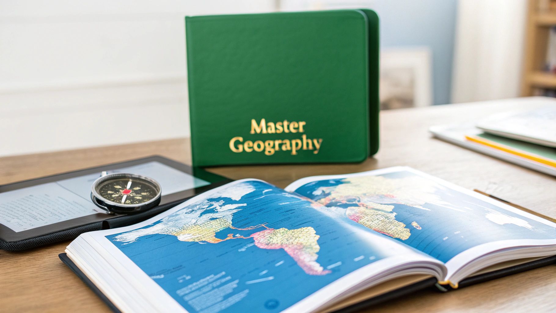
10 Proven Methods: The Best Way to Learn Geography in 2025
Discover the best way to learn geography with our complete 2025 guide. Explore 10 proven methods, from GIS and gaming to VR, for all learning styles.
Learning geography is far more than just memorizing capitals and country outlines; it's about understanding the intricate web of systems that shape our world. From physical landscapes and climate patterns to cultural connections and geopolitical dynamics, geography provides a powerful lens for interpreting everything around us. It connects the "where" with the "why," explaining how a mountain range can influence trade routes or how a river can define cultural boundaries for centuries.
But with so many different approaches available, what is truly the best way to learn geography for deep, lasting knowledge? The answer isn't a single technique but a combination of methods tailored to your personal learning style and specific goals. This guide moves beyond generic advice to offer a comprehensive roundup of ten proven strategies, each designed to build a more intuitive and interconnected understanding of the planet.
Whether you're a hands-on explorer, a digital native, or a visual learner, you'll find actionable strategies to transform your global awareness. We'll explore a diverse toolkit that includes:
- Traditional cartography and physical map analysis.
- Cutting-edge virtual reality and immersive experiences.
- Gamified learning platforms and interactive challenges.
- Deep-dive thematic studies and regional explorations.
This list is your roadmap to finding the most effective and engaging path. It provides the tools you need to build not just a mental atlas of places, but a profound understanding of the forces that define them. Let's begin the journey to achieving true global fluency.
1. Master the Planet with Interactive Digital Mapping and GIS
Geographic Information Systems (GIS) and interactive digital maps are the modern explorer's essential tools. Unlike static paper maps, these dynamic platforms allow you to overlay and analyze multiple layers of information, turning a flat image into a multi-dimensional story. This is arguably the best way to learn geography because it moves you from simply memorizing locations to actively investigating spatial relationships and real-world phenomena.
By engaging with GIS, you can visualize everything from population density and climate patterns to historical borders and real-time satellite imagery. You become a geographical detective, uncovering patterns and connections that are invisible on a traditional map. This hands-on method transforms learning into an act of discovery.
How to Implement This Method
Getting started with interactive mapping is easier than ever. You don't need to be a professional cartographer to harness its power.
- Start with User-Friendly Platforms: Begin with accessible tools like Google Earth or National Geographic's MapMaker. These platforms offer vast datasets and intuitive interfaces perfect for beginners.
- Layer Different Data Sets: Experiment by adding multiple layers. For example, overlay a map of global shipping routes with a map of major world cities. You’ll immediately see how trade dictates urban development.
- Explore Specific Themes: Focus on a topic that interests you, like volcanology. Use a GIS tool to map the "Ring of Fire," then add layers for tectonic plate boundaries and recent earthquake data to understand the underlying geology.
Key Insight: The true power of GIS lies in its ability to answer "why" and "how" questions, not just "where." By layering data, you build a comprehensive understanding of geographical systems.
Recommended Resources
- ArcGIS Online: A powerful, cloud-based mapping platform from Esri. It offers a free public account for non-commercial use, providing access to incredible datasets and analytical tools.
- QGIS: A free and open-source GIS application that is a favorite among professionals and hobbyists alike. It has a steep learning curve but offers immense capabilities.
- Google Earth: Excellent for 3D visualization, historical imagery, and exploring both natural and man-made landscapes.
2. Physical Map Study and Cartography Analysis
In an era of digital navigation, the tactile experience of studying a physical map remains one of the most powerful ways to build foundational geographic knowledge. This traditional method involves engaging directly with paper maps, atlases, and globes to develop an intuitive sense of place, scale, and spatial relationships. It's an excellent way to learn geography because it forces a deeper, more focused engagement than a quick digital search.
Analyzing a physical map requires you to decode its language: the symbols, the legend, the contour lines, and the projection. This process of cartographic analysis builds a robust mental model of the world, helping you understand not just where a place is, but also its physical characteristics and its relationship to neighboring regions. This hands-on approach anchors geographical concepts in a tangible way.
How to Implement This Method
Diving into physical maps is a rewarding and accessible activity. It's about more than just looking; it's about actively interpreting the information presented.
- Trace and Re-draw: A classic technique for a reason. Trace the outlines of continents, countries, or states. Then, try to draw them from memory. This active recall solidifies shapes and locations in your mind.
- Use Atlases for Thematic Study: Don't just look at political maps. Use a comprehensive atlas like the National Geographic Atlas of the World to compare maps of the same region showing different data, such as climate, population density, or natural resources.
- Analyze Topography: Get a topographic map of a local area (like a USGS map) and learn to read the contour lines. This will teach you to visualize mountains, valleys, and slopes from a 2D representation, a crucial skill in physical geography.
Key Insight: Physical maps are curated narratives of a place. By learning to read their elements, you are not just finding locations; you are interpreting the story the cartographer intended to tell about the landscape and its features.
Recommended Resources
- National Geographic Atlases: Considered the gold standard for their detail, accuracy, and beautiful cartography. They offer a wealth of thematic maps in addition to political and physical ones.
- Ordnance Survey (UK) and USGS (USA) Maps: These agencies produce incredibly detailed topographic maps that are essential for understanding physical landscapes on a local scale.
- Historical Map Collections: Many libraries and online archives (like the David Rumsey Map Collection) have extensive collections of historical maps. Comparing these to modern maps provides a fascinating lesson in geopolitics and exploration. For more on how maps shape our view of the world, explore some alternative map projections.
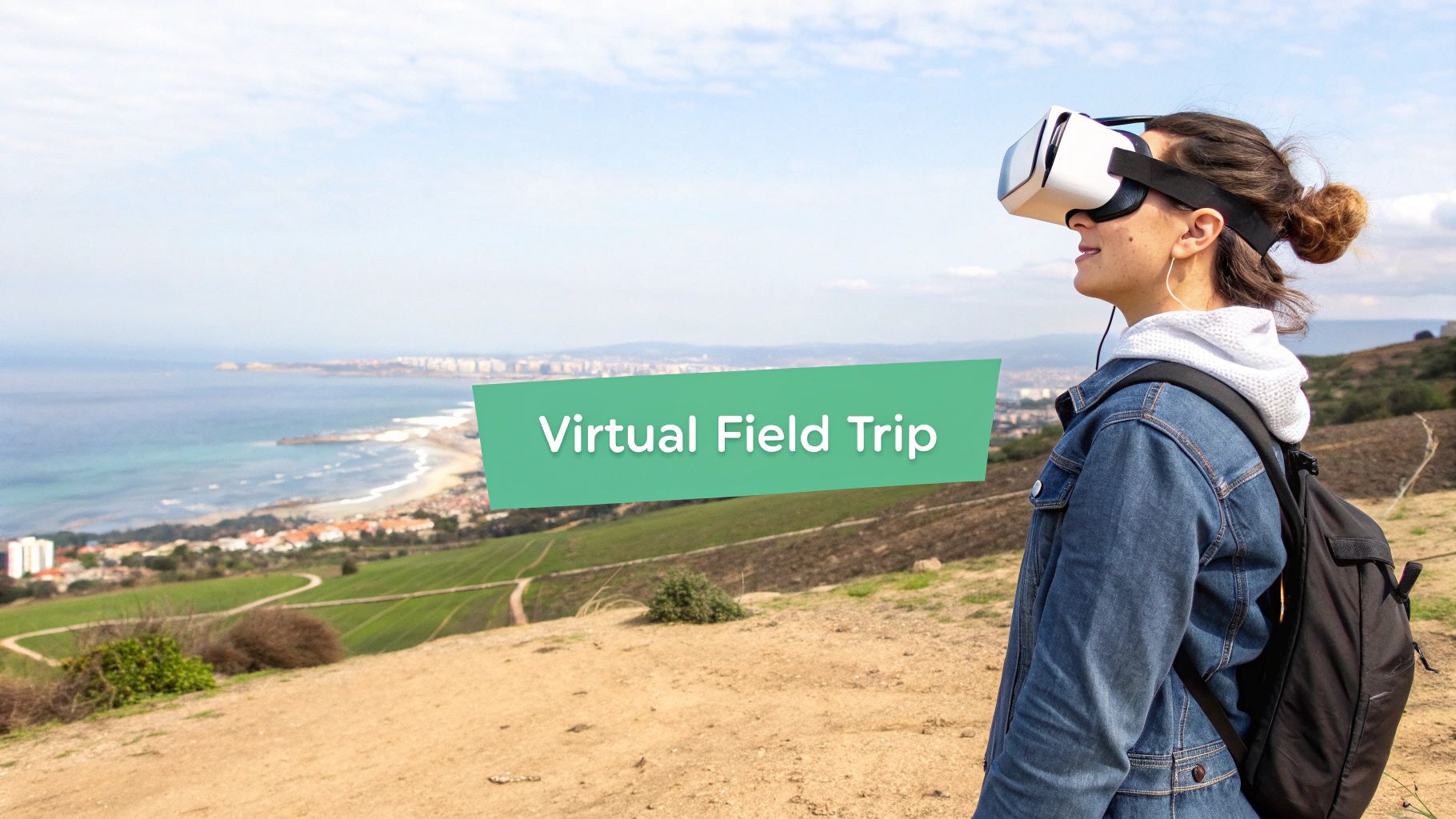
3. Virtual Reality (VR) and Immersive Experiences
Virtual Reality (VR) offers a groundbreaking way to learn geography by teleporting you directly into the environments you are studying. This technology moves beyond two-dimensional maps and videos, creating fully immersive, three-dimensional experiences. Instead of just reading about the Amazon rainforest, you can stand on the forest floor, and instead of looking at a diagram of a volcano, you can virtually stand at its crater's edge.
This visceral, first-person perspective forges a powerful connection to places, making abstract geographical concepts tangible and memorable. By engaging multiple senses, VR deepens your understanding of scale, topography, and spatial relationships in a way that traditional media simply cannot replicate. It transforms passive learning into an active, unforgettable exploration.
How to Implement This Method
You don't need a complex setup to start your virtual geographical journeys. Modern VR is more accessible than ever and offers powerful educational tools.
- Start with Guided Virtual Field Trips: Use apps that offer curated tours of significant geographical locations. This provides context and narrative, guiding your exploration of places like the Grand Canyon, Mount Everest, or the Great Barrier Reef.
- Explore Inaccessible Environments: VR allows you to safely visit places that are otherwise dangerous or impossible to reach. Take a virtual dive into the Mariana Trench or explore the surface of Mars to understand extreme geography.
- Combine VR with Traditional Study: Use VR to supplement your learning. After reading about glacial erosion, use a VR experience to "fly" over a fjord and see the U-shaped valleys for yourself, solidifying the concept.
Key Insight: VR's true strength is its ability to create "presence," the feeling of actually being in a location. This emotional and sensory engagement significantly boosts retention and comprehension.
Recommended Resources
- Google Earth VR: A stunning application that lets you fly anywhere in the world, stand atop mountains, and explore cities in breathtaking detail. It is a must-have for any geography enthusiast with a VR headset.
- National Geographic VR: Offers cinematic, high-quality virtual reality experiences that take you on expeditions to places like Antarctica and Machu Picchu, often with expert narration.
- BRINK Traveler: Features hyper-realistic virtual travel to some of the world's most amazing natural landmarks, allowing for detailed exploration and learning.
4. Documentary and Film-Based Learning
Visual storytelling is a powerful educational tool, and high-quality documentaries offer a cinematic journey into the world's diverse geographies. This method immerses you in landscapes, cultures, and ecosystems, connecting abstract geographical concepts to vivid, real-world imagery. Learning geography this way transforms a subject of facts and figures into a compelling narrative of places and people.
By watching films from creators like the BBC Natural History Unit or National Geographic, you can witness the formation of a volcano, traverse the Amazon rainforest, or explore the societal structures of a remote Himalayan village. This approach provides crucial context that maps alone cannot, building an emotional and intuitive understanding of how physical environments shape life.
How to Implement This Method
Transform passive viewing into an active learning experience to get the most out of geographical films. This is about engagement, not just entertainment.
- Practice Active Viewing: Don't just watch; take notes on key geographical features, cultural practices, or environmental challenges presented. Pause the film to look up unfamiliar locations on a map.
- Connect Themes Across Films: Watch a documentary about the Sahara Desert and another about the Arctic tundra. Compare and contrast the survival strategies of the flora, fauna, and human populations in these extreme climates.
- Follow Up with Research: If a segment on glacial retreat in Patagonia sparks your interest, use it as a jumping-off point for further reading. Investigate the causes, track the data, and understand the wider implications. Understanding how filmmakers create educational videos that engage students can also provide insight into how information is structured for maximum impact.
Key Insight: Documentaries excel at showing the interconnectedness of physical and human geography, illustrating how climate, topography, and culture are deeply intertwined.
Recommended Resources
- Planet Earth (I, II, & III): The landmark BBC series narrated by David Attenborough is a masterclass in showcasing the world's biomes and the creatures that inhabit them.
- National Geographic Documentaries: Available on Disney+ and other platforms, these films cover everything from ancient civilizations to modern-day environmental science with stunning cinematography.
- Our Planet: This Netflix series provides breathtaking visuals while focusing heavily on the impact of climate change on different ecosystems, making it a crucial resource for contemporary geographical issues.
5. Travel and Field Expeditions
There is no substitute for standing on the ground you are studying. Travel and field expeditions offer the ultimate immersive learning experience, transforming abstract geographical concepts into tangible, multi-sensory realities. This method is a powerful way to learn geography because it moves knowledge from the page to the real world, connecting you directly with landscapes, climates, cultures, and ecosystems.

By physically visiting a location, you can observe firsthand how a river carves a valley, feel the climate shift as you gain altitude, or understand the relationship between a city's port and its economic prosperity. This experiential approach creates deep, lasting memories and a nuanced understanding that reading alone cannot provide. It’s the difference between reading about a rainforest and feeling its humidity and hearing its sounds.
How to Implement This Method
You don't need to join a major scientific expedition to benefit from this hands-on approach. Fieldwork can be adapted to any scale, from a local park to an international journey.
- Plan with Geographic Intent: Before you travel, research the physical and human geography of your destination. Identify key features you want to observe, whether it's a unique geological formation, an urban planning model, or a specific agricultural practice.
- Keep a Detailed Field Journal: Document your observations rigorously. Note the weather, sketch landscapes, describe the local flora and fauna, and record conversations with local people. This practice hones your observational skills.
- Compare Observations with Data: Actively connect what you see on the ground with maps, satellite imagery, and other data. For instance, compare your on-site observations of coastal erosion with historical maps of the same coastline.
Key Insight: Field expeditions turn you into an active participant in the geographical narrative. You are no longer just a consumer of information but a primary data collector and interpreter.
Recommended Resources
- National Geographic Expeditions: Offers a wide range of expert-led trips focusing on culture, wildlife, and conservation across the globe, providing unparalleled educational travel experiences.
- University Study Abroad Programs: Many universities offer geography-focused study abroad or field-school programs that provide academic credit for immersive, hands-on research.
- Road Scholar: An organization offering educational travel adventures for adults, often with a strong focus on the geography, history, and culture of a region.
6. Enroll in Online Courses and MOOCs for Structured Learning
For those who thrive with structure, online courses and Massive Open Online Courses (MOOCs) offer a guided, academic approach to learning geography. These platforms provide university-level curricula, complete with video lectures, readings, and assignments, all accessible from home. This method is an excellent way to learn geography because it breaks down complex topics into digestible modules, ensuring you build a solid foundational knowledge before moving on to more advanced concepts.
Unlike self-directed study, these courses are designed by experts to lead you through a logical progression of material. They cover everything from physical geography and human-environment interactions to specialized fields like urban planning or climatology. This structured path prevents knowledge gaps and provides the context needed to truly understand how geographical systems function.
How to Implement This Method
Leveraging MOOCs effectively requires discipline, but the payoff is a deep, comprehensive understanding of the subject.
- Choose Courses That Match Your Goals: Identify what you want to learn. Are you interested in the basics of physical geography or a deep dive into geopolitical analysis? Platforms like Coursera and edX allow you to filter by topic, level, and institution.
- Engage with Course Materials: Don't just passively watch videos. Actively participate in discussion forums, complete all quizzes and assignments, and take detailed notes. This active engagement is crucial for retention.
- Create a Study Schedule: Treat your online course like a real class. Set aside specific times each week for lectures and homework to stay on track and avoid falling behind.
Key Insight: The true value of online courses lies in their structured curriculum and expert instruction, which provide a clear and reliable roadmap for mastering complex geographical topics.
Recommended Resources
- Coursera: Offers a wide range of geography courses from top universities like Duke and the University of Colorado Boulder, covering topics from GIS to sustainability.
- edX: A non-profit platform founded by Harvard and MIT, providing high-quality courses on environmental science, urbanization, and global development.
- FutureLearn: Known for its highly interactive courses and social learning components, offering unique modules on topics like "The Geography of Food" and "Climate Change: The Science."
7. Mnemonic Devices and Memory Techniques
Our brains are not wired to remember endless lists of raw data, but they excel at recalling stories, images, and patterns. Mnemonic devices leverage this natural ability by translating dry geographical facts into memorable formats like acronyms, rhymes, or vivid mental associations. This is one of the best ways to learn geography because it builds a mental scaffold for information that would otherwise be difficult to retain.
Instead of brute-forcing the names of the Great Lakes, you can simply remember the word "HOMES" (Huron, Ontario, Michigan, Erie, Superior). This technique transforms abstract data into a concrete, easily retrievable package. By using these memory aids, you create durable neural pathways that make recalling capital cities, country locations, and mountain ranges almost effortless.
How to Implement This Method
Integrating memory techniques into your study routine is a creative process that gets easier with practice. The key is to make the associations personal and memorable.
- Create Acronyms and Acrostics: For lists of countries or features, create a memorable word or sentence from the first letter of each item. For the Central American countries in order from north to south, you could use "Big Gorillas Eat Hotdogs, Not Cold Pizza" (Belize, Guatemala, El Salvador, Honduras, Nicaragua, Costa Rica, Panama).
- Use Rhymes and Songs: Set geographical information to a familiar tune or create a simple rhyme. Many people learned the 50 U.S. states through a song; the same principle can be applied to continents, oceans, or major rivers.
- Employ the Memory Palace Technique: Associate specific geographical facts with objects in a familiar physical location, like your home. To remember the capital of Australia is Canberra, you might visualize a can of berries sitting on your front doormat.
Key Insight: The most effective mnemonics are often the most absurd, personal, or humorous. Don't be afraid to create vivid, strange mental images, as they are far more likely to stick in your memory.
Recommended Resources
- Anki: A powerful flashcard app that uses spaced repetition. You can create your own flashcards with mnemonic images or phrases. For powerful memory enhancement, consider reading about mastering spaced repetition studying to supercharge this method.
- Art of Memory Forum: An online community dedicated to memory techniques. You can find pre-made mnemonics for geography and learn advanced methods from experienced practitioners.
- World Geography Games: Websites like Seterra and World Geography Games often incorporate mnemonic learning principles into their quiz formats, helping you build associations through gameplay.
8. Turn Learning into an Adventure with Interactive Games and Gamification
Gamification transforms the often-daunting task of memorizing countries, capitals, and physical features into an engaging and competitive adventure. This method applies game-like elements such as points, leaderboards, and achievements to educational content, tapping into our natural desire for play and competition. It's an exceptionally effective way to learn geography because it makes repetition and practice enjoyable, leading to better knowledge retention without the feeling of traditional study.

By turning geographical challenges into interactive quests, you build muscle memory for locations and facts. You’re no longer just staring at a map; you are actively racing against the clock to identify a river, pinpoint a city, or recognize a country’s flag. This active recall process strengthens neural pathways far more effectively than passive reading. The instant feedback provided by games helps correct mistakes immediately, reinforcing the correct information.
How to Implement This Method
Integrating games into your learning routine is simple and can be done in short, fun bursts. The key is to be intentional with your playtime.
- Start with Focused Quizzes: Begin with platforms like Seterra or Sporcle to drill down on specific regions or topics, such as "Countries of Africa" or "Major World Rivers."
- Challenge Friends or Classmates: Use platforms like Kahoot! to create friendly competitions. Competing against others adds a powerful motivational layer to the learning process.
- Explore and Discover with GeoGuessr: Move beyond simple quizzes with games like GeoGuessr, which drops you in a random location on Google Street View. You must use geographical clues like language, architecture, and vegetation to deduce where you are.
Key Insight: Gamification works because it provides immediate rewards and clear goals, turning the abstract process of learning into a tangible series of accomplishments. Learn more about the power of gamification in education on earthchasers.com.
Recommended Resources
- GeoGuessr: An immersive discovery game that builds real-world deductive skills and geographical intuition.
- Seterra: Offers a massive library of free map-based quizzes covering everything from countries and capitals to flags and physical features.
- Sporcle: A trivia powerhouse with thousands of user-created geography quizzes that test your knowledge in fun and fast-paced formats.
9. Thematic and Regional Deep-Dive Studies
Moving beyond broad overviews, the deep-dive approach involves an intensive, focused study of a specific geographical theme or region. Instead of learning a little about everywhere, you learn everything about somewhere. This method is a powerful way to understand how multiple geographical elements-like climate, culture, politics, and economics-interconnect to create a unique and complex system.
This focused study transforms abstract concepts into tangible realities. By concentrating on one area, such as the Amazon rainforest ecosystem or urbanization patterns in Sub-Saharan Africa, you develop a sophisticated understanding of systems thinking. This is an advanced technique and one of the best ways to learn geography because it builds a framework of expertise that can be applied to other regions and themes.
How to Implement This Method
Adopting a deep-dive approach requires structure and a commitment to synthesis. It’s about building a comprehensive knowledge base from various sources.
- Select a Focused Topic: Choose a specific theme (e.g., global water cycles) or a well-defined region (e.g., the geopolitical landscape of the Middle East). Your interest will fuel the learning process.
- Synthesize Multiple Sources: Go beyond a single textbook. Consult academic journals, documentaries, news articles, and primary sources to gather diverse perspectives on your chosen topic.
- Connect Interrelated Elements: As you study, constantly ask how different factors relate. For instance, when analyzing the Asian monsoon systems, connect atmospheric science to its impact on agriculture, culture, and economies in the region.
- Create a Synthesis Project: Solidify your understanding by creating a summary document, a presentation, or a detailed concept map that illustrates the key connections and systems at play.
Key Insight: A deep-dive study teaches you that geography is not just a collection of facts, but a web of interconnected systems. Mastering one system provides a mental model for understanding all others.
Recommended Resources
- Academic Journals (via Google Scholar or JSTOR): Access in-depth research papers on virtually any geographical topic, offering specialized knowledge from leading experts.
- National Geographic: Offers extensive articles, documentaries, and maps that provide rich, multi-faceted explorations of specific regions and environmental themes.
- Think Tank Publications (e.g., Council on Foreign Relations, Chatham House): Excellent for deep-dives into geopolitical regions, providing detailed analysis of the interplay between geography and international affairs.
10. Social Media and Crowdsourced Geographic Knowledge
In the digital age, geography is no longer confined to textbooks; it's a living, breathing conversation happening across social media and collaborative platforms. Tapping into these communities offers a dynamic, real-time way to learn, fueled by the collective knowledge and diverse perspectives of geographers, educators, and enthusiasts from around the globe. This method turns passive learning into an active, social experience.
By following geography-focused communities on platforms like Reddit, Instagram, or Twitter, you gain access to a constant stream of fascinating content, from stunning satellite imagery and unique cultural landscapes to breaking news analysis and deep-dive discussions on geopolitical events. This approach makes learning geography a daily habit, connecting you with people who share your passion and providing insights you'd never find in a formal curriculum.
How to Implement This Method
Engaging with online geography communities is a simple yet powerful way to expand your understanding of the world. It’s about curating your digital environment to foster continuous learning.
- Curate Your Feeds: Actively follow geography-focused accounts. On Reddit, join subreddits like r/geography and r/MapPorn. On Instagram, follow accounts like @geographymatters or National Geographic's official page.
- Participate in Discussions: Don’t just be a passive observer. Ask questions in Reddit threads, comment on Instagram posts, and join Twitter conversations. Engaging with the content deepens your understanding and connects you with experts.
- Contribute to Crowdsourced Projects: Take your learning a step further by contributing to platforms like OpenStreetMap. By mapping your local area or contributing to humanitarian mapping projects, you actively apply your geographic knowledge for a real-world purpose.
Key Insight: Social media transforms geography from a solitary study into a collaborative exploration. It leverages the "wisdom of the crowd" to provide a constantly updated and multi-faceted view of our planet.
Recommended Resources
- Reddit Communities: Subreddits like r/geography, r/MapPorn, and r/imaginarymaps are incredible hubs for discussion, data visualization, and creative cartography.
- Geography on Instagram: Follow accounts like @cariocageografia and @geography.everything for a daily dose of visually stunning geographic content and bite-sized facts.
- OpenStreetMap: A collaborative, free, and editable map of the world. Contributing is a hands-on way to learn about cartography and data collection.
Comparison of 10 Geography Learning Methods
| Method | Implementation Complexity 🔄 | Resource Requirements ⚡ | Expected Outcomes ⭐ | Ideal Use Cases 📊 | Key Advantages & Tips 💡 |
|---|---|---|---|---|---|
| Interactive Digital Mapping and GIS Software | High 🔄🔄 — steep learning curve for advanced tools | Moderate–High ⚡⚡ — powerful PC, possible licenses (free options exist) | High ⭐⭐⭐ — spatial analysis skills, real-world data handling | Research, lab classes, data-driven projects 📊 | Hands-on visualization; start with QGIS/Google Earth; follow targeted tutorials 💡 |
| Physical Map Study and Cartography Analysis | Low–Moderate 🔄 — manual skills, map literacy | Low ⚡ — paper maps, pens, atlases | Moderate ⭐⭐ — spatial reasoning, retention | Introductory courses, tactile classrooms, basics of map reading 📊 | Builds fundamentals; practice tracing and compare projections 💡 |
| Virtual Reality (VR) and Immersive Experiences | High 🔄🔄 — setup and content creation complexity | Very High ⚡⚡⚡ — headsets, hardware, content access | Very High ⭐⭐⭐ — immersive, memorable spatial understanding | Simulated field visits, dangerous/inaccessible sites, experiential lessons 📊 | Use short sessions; pair with pre/post discussion; watch for motion sickness 💡 |
| Documentary and Film-Based Learning | Low 🔄 — curate and present media | Low–Moderate ⚡ — streaming or screening resources | Moderate–High ⭐⭐⭐ — contextual and cultural understanding | Overviews, cultural geography, classroom prompts and discussions 📊 | Pause to discuss, cross-reference maps, take active notes 💡 |
| Travel and Field Expeditions | High 🔄🔄 — planning, logistics, permits | Very High ⚡⚡⚡ — travel costs, time, safety resources | Very High ⭐⭐⭐ — deep, lasting experiential learning | Field research, immersive study, hands-on data collection 📊 | Keep detailed field journals; prepare and assess risks; document observations 💡 |
| Online Courses and MOOCs | Low–Moderate 🔄 — follows structured instruction | Low–Moderate ⚡ — internet, device; many low-cost/free options | Moderate–High ⭐⭐⭐ — structured knowledge, certificates | Self-paced study, credentialing, topic breadth coverage 📊 | Set goals, participate in forums, complete assignments for retention 💡 |
| Mnemonic Devices and Memory Techniques | Low 🔄 — easy to design and apply | Minimal ⚡ — no special resources | High for factual recall ⭐⭐⭐ — capitals, lists, positions | Memorizing facts (capitals, country lists), exam prep 📊 | Use vivid personal imagery; combine techniques; practice spaced repetition 💡 |
| Interactive Games and Gamification | Low–Moderate 🔄 — game setup and scaffolding | Low ⚡ — apps, browser games, devices | Moderate ⭐⭐ — engagement and recall practice | Practice drills, classroom engagement, motivational learning 📊 | Use as supplement, set learning targets, combine with map study 💡 |
| Thematic and Regional Deep-Dive Studies | Moderate–High 🔄 — sustained research and synthesis | Moderate ⚡⚡ — access to diverse sources and time | High ⭐⭐⭐ — systems understanding and expertise | University courses, research projects, policy analysis 📊 | Create study plans, synthesize multiple sources, produce summaries and reviews 💡 |
| Social Media & Crowdsourced Geographic Knowledge | Low–Moderate 🔄 — curation and critical evaluation | Low ⚡ — internet access, community platforms | Variable ⭐⭐ — diverse perspectives but uneven depth | Real-time events, grassroots mapping, community learning 📊 | Follow verified experts, cross-check claims, contribute thoughtfully 💡 |
Your Next Expedition: Crafting Your Personal Geography Curriculum
We've embarked on a comprehensive expedition, exploring ten powerful and diverse methods to master the world around us. From the analytical precision of GIS software and the tangible connection of physical maps to the immersive digital realms of virtual reality and gamified platforms, we’ve uncovered that there isn't a single, monolithic answer to the question of the best way to learn geography. Instead, the most effective path is a custom-built curriculum, a personalized journey that you design for yourself.
The true power lies not in choosing one method, but in the art of combination. The strategies detailed in this guide are not isolated islands; they are interconnected continents of knowledge. By blending these techniques, you create a robust, multi-layered learning experience that prevents burnout and builds a more profound, holistic understanding of our planet.
Synthesizing Your Strategy for Success
To move from passive reader to active explorer, the next step is to synthesize these ideas into a practical routine. The goal is to build a learning system that is as dynamic and fascinating as geography itself. Consider how different approaches can reinforce one another.
- Pairing the Analog with the Digital: Use a physical globe or atlas to trace the journey you see in a compelling geography documentary. This simple act connects the cinematic narrative to a tangible spatial context, making the information stick.
- Combining Structure with Spontaneity: Enroll in a structured online course (MOOC) to build a solid foundation in physical or human geography. Then, supplement that formal learning with daily, bite-sized challenges on a gamified app, turning study into a fun, competitive habit.
- Connecting Macro to Micro: After exploring a continent through an immersive VR experience, zoom in on a specific city or natural feature using interactive digital maps like Google Earth. This toggling between scales is crucial for developing a sophisticated geographical perspective.
This process of "stacking" learning methods creates a web of knowledge. When you encounter a place name in a news article, your brain won't just recall a dot on a map. It will retrieve the memory of flying over its terrain in VR, the facts you learned from a thematic deep-dive, and the visual data you analyzed in a GIS tool. This is the essence of true geographical literacy.
From Knowledge to Wisdom: The Real-World Impact
Mastering geography is more than an academic pursuit or a trivia night triumph. It is about developing a critical lens through which to view the world. Understanding the spatial relationships between cultures, economies, and environments empowers you to grasp the complexities behind global headlines, from climate change and supply chain disruptions to geopolitical tensions.
Key Takeaway: The best way to learn geography is to become an active curator of your own education. Experiment with the tools and techniques we've explored, find what excites you, and weave them into a personalized learning tapestry.
Your journey to understanding the world doesn't have to be a solitary or purely academic endeavor. It can be an adventure, a game, and a daily discovery. The most important step is the one you take right now. Choose one or two methods from this guide that sparked your curiosity and commit to trying them this week. Your expedition awaits.
Ready to turn learning into an adventure? EarthChasers combines the thrill of gaming with real-world geographic discovery, making it a powerful tool in your learning arsenal. Explore, compete, and master your knowledge of the planet by joining our community today at EarthChasers.