The 12 Best Interactive Map of Spanish Speaking Countries Tools for 2025
Explore our curated list of the top 12 tools for an interactive map of Spanish speaking countries. Find games, quizzes, and classroom resources for 2025.

Navigating the vast expanse of the Spanish-speaking world requires more than a static, flat image. Finding the right interactive map of Spanish speaking countries can transform how you study geography, plan trips, or dominate trivia night. This guide cuts through the clutter to present the best online mapping tools, each selected for its unique features and practical applications. Whether you need a sophisticated 3D exploration platform like EarthChasers or a simple quiz-based game, this resource list is designed to help you find the perfect tool for your specific goals.
We've compiled a curated selection of platforms, from powerful data visualization tools to engaging educational games. For each resource, you'll find a concise breakdown of its core features, ideal use cases, and honest limitations. We provide quick tips to get you started, along with screenshots and direct links, so you can immediately begin exploring. Forget sifting through endless search results; this is your direct path to the most effective and engaging interactive maps available. From classroom activities to personal discovery, you will find the right digital globe or mapping application to meet your needs and bring the vibrant geography of the Hispanophone world to life.
1. EarthChasers
Best For: Immersive 3D Exploration and Gamified Learning
EarthChasers sets itself apart by transforming the concept of an interactive map of Spanish-speaking countries into an engaging, photorealistic 3D experience. Built on Google Maps' advanced technology, the platform allows you to virtually "fly" into the heart of Madrid, explore the Andes mountains surrounding Santiago, or navigate the historic streets of Mexico City with stunning realism. This immersive quality makes it an exceptional tool for both education and entertainment, moving beyond flat maps to provide true-to-life context.
The platform excels as a dual-purpose resource. Its core is a geography game with modes like "Countries" and "Cities," where you can specifically test your knowledge of the Spanish-speaking world. For educators, the ability for users to create and share their own custom maps presents a unique opportunity for tailored classroom activities. A student could create a "Capitals of South America" challenge, for example, making learning a hands-on, competitive experience.
Key Strengths and Use Cases
- Photorealistic Exploration: The 3D view is unparalleled for understanding topography and urban layouts. Use it to plan a hypothetical trip through Spain or to visually comprehend the geographical diversity from the Caribbean to Patagonia.
- Gamified Learning: The daily challenges and leaderboards turn geography practice into a compelling habit. This is ideal for students who thrive on competition or anyone looking to sharpen their world knowledge in a fun way.
- Free Professional Tools: Beyond the game, EarthChasers offers a suite of powerful, no-cost utilities like an Elevation Finder and Line of Sight Calculator, which are incredibly useful for academic projects, hobbyist research, or even professional planning.
Platform Access and Considerations
The entire gameplay experience and the professional mapping tools are accessible for free without requiring an account, which is a significant advantage for quick use or classroom settings. While an "Upgrade to Pro" option exists, its specific features and pricing are not detailed on the site. A stable internet connection and a modern browser are necessary to handle the photorealistic 3D rendering effectively. The platform’s approach to combining play with practical tools makes it a standout choice for anyone serious about exploring the globe. As discussed in their article, educational games can significantly boost geography retention.
Website: https://earthchasers.com
2. Scribble Maps
Scribble Maps is a versatile, browser-based tool perfect for creating or finding a custom interactive map of Spanish speaking countries. Its core strength lies in annotation and personalization, allowing users to draw, add labels, place markers, and overlay information directly onto a map. This makes it an invaluable resource for educators designing a lesson plan or a community organizer plotting local Hispanic heritage sites.
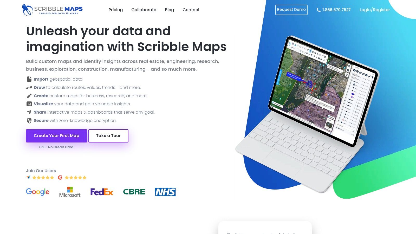
The platform hosts a public gallery where you can often find pre-made maps. A quick search for "países hispanohablantes" can yield useful starting points. However, the true power is in its creation tools. You can easily highlight all 20 Spanish-speaking nations, add notes about regional dialects, or even plot a hypothetical travel route through Central and South America. For a deeper dive into the map creation process, you can explore tutorials on how to create custom maps on earthchasers.com.
Key Features & Use Cases
| Feature | Best Use Case |
|---|---|
| Drawing & Annotation Tools | Creating custom study guides for geography class. |
| Public Map Gallery | Finding quick, user-generated examples for presentations. |
| Easy Embedding | Adding a customized map to a blog post or school website. |
| Layering Capabilities | Separating political boundaries, linguistic zones, and travel routes. |
Pros:
- No software installation needed; fully browser-based.
- Excellent for annotating specific regions for educational purposes.
Cons:
- Quality of public, user-made maps can be inconsistent.
- Advanced features like high-res exports require a paid subscription.
Website: https://www.scribblemaps.com
3. Seterra (GeoGuessr)
Seterra, now part of the GeoGuessr family, transforms learning into a game. It offers a purpose-built quiz that serves as a fun and effective interactive map of Spanish speaking countries. Rather than a creation tool, Seterra is a challenge platform where users identify the 21 Spanish-speaking nations on a map. This gamified approach is perfect for students, trivia buffs, or anyone looking to test and improve their geographical knowledge quickly.

The platform offers multiple game modes, such as clicking the correct country on a map ("Pin") or typing its name. This variety keeps the learning process engaging and helps reinforce memory through repetition. For educators, Seterra also provides printable maps and worksheets for offline classroom activities. To see how this tool can be used for practice, check out this guide to a Latin American countries quiz on earthchasers.com. Its straightforward interface and focused goal make it a top choice for assessment and practice.
Key Features & Use Cases
| Feature | Best Use Case |
|---|---|
| Multiple Game Modes | Reinforcing knowledge through varied repetition (clicking vs. typing). |
| Score Tracking | Competing against yourself or classmates to improve speed and accuracy. |
| Printable Worksheets | Providing offline practice or in-class assessments for students. |
| Focused Activity | Quickly learning and memorizing all 21 Spanish-speaking countries. |
Pros:
- Gamified learning makes memorization engaging and fun.
- Low-friction classroom use with a multilingual interface.
Cons:
- Limited map customization compared to full GIS tools.
- Some features may require a GeoGuessr login or subscription.
Website: https://www.geoguessr.com/seterra
4. MapChart
MapChart is a streamlined, browser-based tool designed for creating beautiful, color-coded maps quickly. While not interactive in a dynamic, data-driven sense, it excels at producing a static yet custom interactive map of Spanish speaking countries perfect for presentations, reports, or educational handouts. Its strength is simplicity; you can click to color countries, create a legend, and generate a high-quality image file in just a few minutes. This makes it a go-to for anyone needing a clean visual aid without the complexity of GIS software.
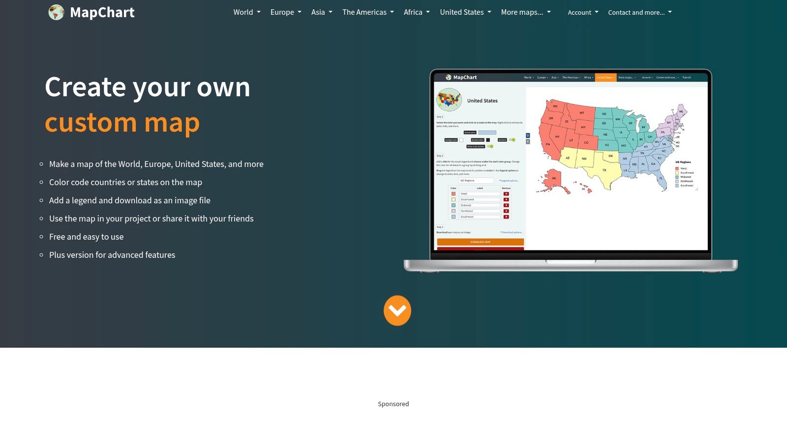
The process is incredibly straightforward. You select a base map (like World, or a specific region like South America), choose a color palette, and simply click on the 20 Spanish-speaking nations to highlight them. The platform then allows you to download your creation as a PNG, JPEG, or scalable SVG file. This is ideal for a teacher preparing a worksheet on "países hispanohablantes" or a blogger needing a custom graphic for a post about Hispanic cultures.
Key Features & Use Cases
| Feature | Best Use Case |
|---|---|
| Click-to-Color Interface | Quickly creating a visual list of Spanish-speaking nations. |
| Legend Maker | Categorizing countries by continent or dialect for a study guide. |
| High-Resolution Exports | Designing clean graphics for slides, social media, or print materials. |
| Multiple Color Themes | Customizing the map to match brand colors or presentation styles. |
Pros:
- Extremely fast and easy to use with no learning curve.
- Clean, professional-looking exports suitable for any project.
Cons:
- Maps are not interactive after being created and exported.
- Lacks data layers, quiz functions, or advanced annotation tools.
Website: https://www.mapchart.net
5. Didactalia Interactive Maps
Didactalia offers a gamified approach to learning with its educational exercises, including a dedicated interactive map of Spanish speaking countries. This platform is less about creation and more about active recall, making it a powerful tool for students and trivia enthusiasts. It turns the process of identifying countries into a fun, engaging challenge with instant feedback, reinforcing geographical knowledge through repetition.
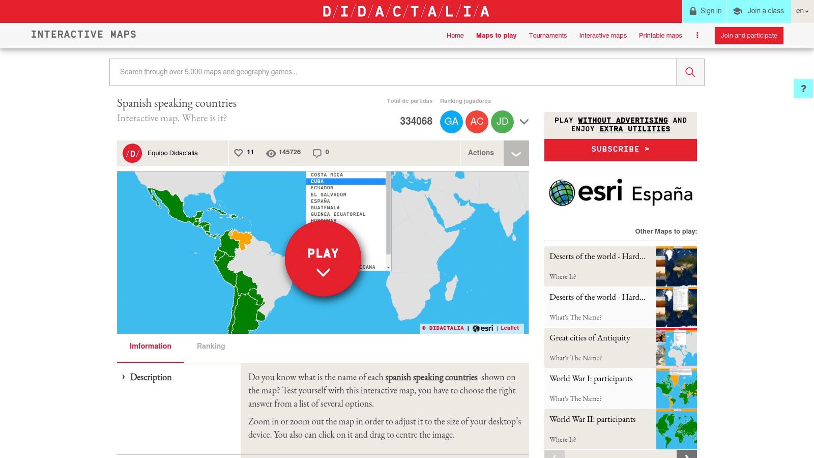
The platform presents two primary game modes: "Where is…?" requires you to find a country on the map, while "What's the name?" asks you to identify a highlighted country. Its multilingual interface makes it particularly useful in bilingual classrooms or for Spanish learners who want to practice country names in their target language. The simplicity of the games allows users to focus purely on memorization and recognition.
Key Features & Use Cases
| Feature | Best Use Case |
|---|---|
| Interactive Game Modes | Classroom quizzes or self-study for geography tests. |
| Instant Feedback System | Quickly correcting mistakes and reinforcing learning. |
| Multilingual Interface | Practicing country names in both English and Spanish. |
| GeoJSON Data Download | For developers or educators wanting to use the map data in other projects. |
Pros:
- Excellent for targeted practice and memorization.
- Suitable for multilingual classrooms with its language options.
Cons:
- The interface is functional but lacks a modern, polished design.
- Free version may display ads or overlays that can be distracting.
6. Rockalingua
Rockalingua offers a unique, gamified approach to geography for younger learners and Spanish language beginners. Instead of a traditional data-heavy map, it provides a kid-friendly game centered on identifying Spanish-speaking countries. Its core purpose is to combine language immersion with geographical knowledge, making it a standout educational tool. The entire interface and its prompts are in Spanish, reinforcing vocabulary while users learn locations.
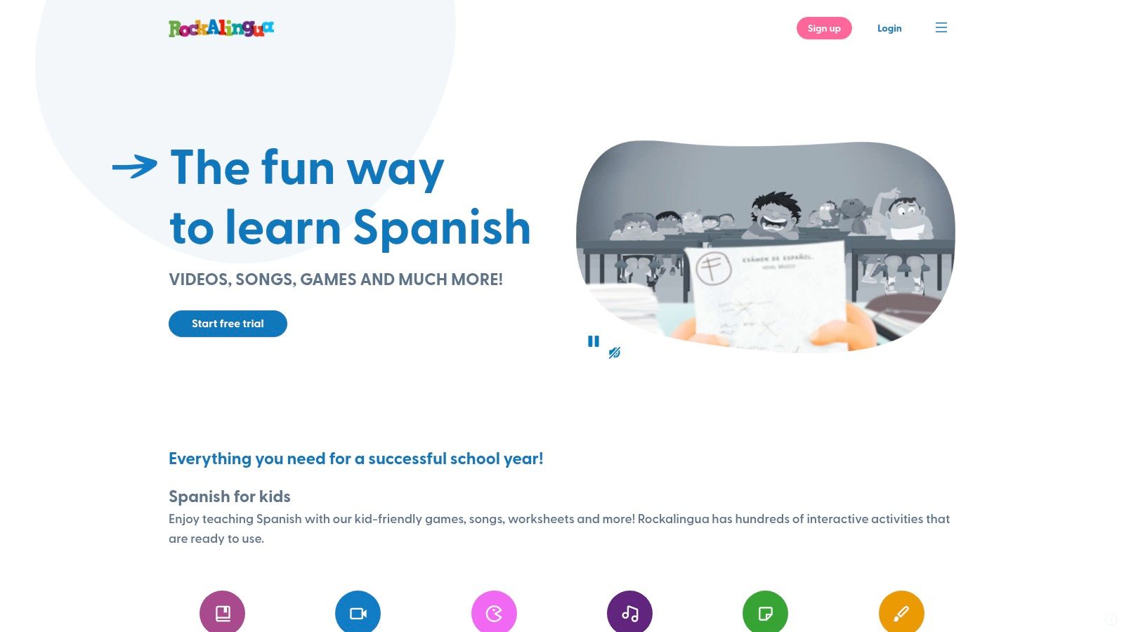
The platform is less about customization and more about guided learning. The game presents a world map and asks users to click on specific "países hispanohablantes" as their names are announced. This creates a direct connection between the country's name, its pronunciation, and its location on the map. It’s an excellent classroom resource for introducing the Hispanic world in an engaging, interactive format that feels more like play than a formal lesson.
Key Features & Use Cases
| Feature | Best Use Case |
|---|---|
| Clickable Map Game | Classroom activities or homework for beginner Spanish students. |
| Spanish-Language Prompts | Reinforcing language skills alongside geography practice. |
| Graded Difficulty Levels | Allowing young learners to build confidence and improve over time. |
| Kid-Friendly Interface | Engaging children who may find traditional maps uninteresting. |
Pros:
- Effectively integrates language learning with geography.
- Designed specifically for children, making it ideal for classroom use.
Cons:
- Full access to all games and materials typically requires a subscription.
- Not a general-purpose mapping tool; lacks customization features.
Website: https://rockalingua.com
7. Wordwall
Wordwall transforms the concept of an interactive map of Spanish speaking countries into a series of engaging classroom games and quizzes. This platform excels at gamified learning, offering template-driven activities where students can drag and drop country names onto a map, match flags to nations, or answer timed trivia questions. It’s an ideal tool for educators looking for a quick, no-prep way to reinforce geographical knowledge.
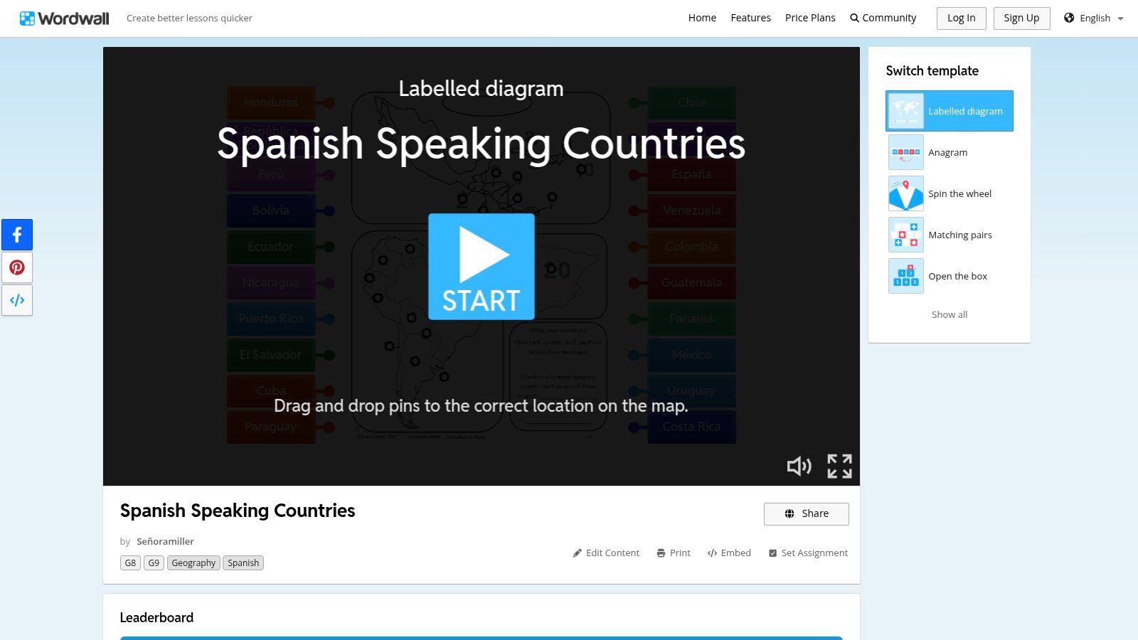
The platform’s strength is its extensive library of user-created content. A search for "Spanish speaking countries" reveals dozens of ready-to-use activities, from simple label-the-map exercises to more complex quizzes. Teachers can assign these directly to students as homework or use them as a dynamic in-class warm-up on an interactive whiteboard. The focus is less on deep map exploration and more on rapid knowledge recall and assessment.
Key Features & Use Cases
| Feature | Best Use Case |
|---|---|
| Ready-Made Activities | Quick, engaging warm-ups or review sessions for Spanish or geography class. |
| Multiple Interactive Templates | Keeping students engaged by varying the format (quizzes, matching, labeling). |
| Leaderboards & Timers | Introducing a fun, competitive element to classroom learning. |
| Assign as Homework | Providing students with interactive, trackable assignments for remote learning. |
Pros:
- Very fast setup; no special mapping skills required.
- Variety of game formats keeps students engaged.
Cons:
- Quality of user-created activities can vary by creator.
- Full access to all templates and features requires a subscription.
Website: https://wordwall.net/resource/95782914/geography/spanish-speaking-countries
8. Teachers Pay Teachers (TPT)
For educators seeking ready-made classroom materials, Teachers Pay Teachers (TPT) is a massive marketplace of teacher-created resources. While not a map generator itself, it’s a goldmine for finding a pre-designed interactive map of Spanish speaking countries in formats like digital notebooks, Google Slides activities, and printable quizzes. You can instantly download affordable, classroom-tested materials designed to engage K-12 students in Hispanic geography.
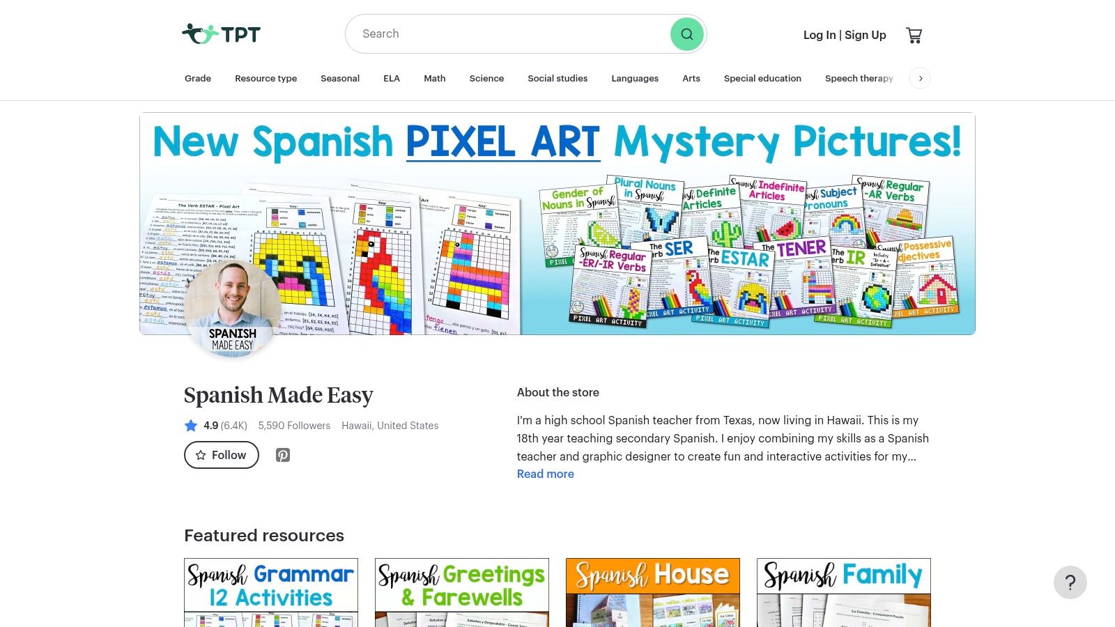
The platform’s strength is its specificity. You can find resources tailored to different grade levels and learning objectives, from simple map-labeling exercises to in-depth cultural projects. User reviews and ratings provide valuable insight into the quality and effectiveness of each download before you buy. This makes it an efficient way to supplement a lesson plan without building an activity from scratch.
Key Features & Use Cases
| Feature | Best Use Case |
|---|---|
| Digital Notebooks & Activities | Assigning interactive geography homework through Google Classroom. |
| Reviews and Ratings | Evaluating the quality and relevance of a resource before purchasing. |
| Instant Digital Downloads | Finding a last-minute activity for a substitute teacher or remote lesson. |
| Vast Resource Library | Sourcing map-based quizzes, games, and projects for a specific unit. |
Pros:
- Affordable, classroom-tested materials created by fellow educators.
- Immediate access to digital downloads supports both remote and in-person learning.
Cons:
- Quality and curriculum alignment can vary significantly between sellers.
- Many resources are printables rather than truly interactive digital tools.
Website: https://www.teacherspayteachers.com/store/spanish-made-easy/social-studies/geography
9. Teacher's Discovery
While not a digital tool, Teacher's Discovery earns its spot by providing the physical counterpart essential for classroom learning: high-quality, large-format wall maps. These durable posters serve as a fantastic, static reference to complement any online interactive map of Spanish speaking countries. Designed specifically for educators, these maps are made from laminated or vinyl materials, making them a lasting fixture in a learning environment where students can physically point to and discuss different nations.
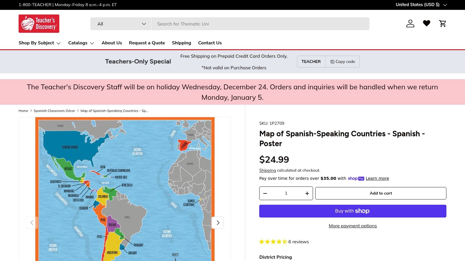
The U.S.-based company specializes in educational materials and understands the needs of schools, offering support for purchase orders. A physical map provides constant visual reinforcement that digital tools, which are only visible when a device is on, cannot. It’s an ideal anchor for lessons, allowing teachers to use it alongside interactive online activities for a blended learning approach.
Key Features & Use Cases
| Feature | Best Use Case |
|---|---|
| Durable, Wipeable Materials | A long-term, reusable classroom display for daily reference. |
| Large-Format Prints | Ensuring visibility for all students in a classroom setting. |
| School Purchase Order Support | Streamlining the procurement process for educational institutions. |
| Static Visual Reference | Grounding digital lessons with a constant, physical map. |
Pros:
- Built to withstand classroom use with durable, laminated surfaces.
- Provides an always-on visual aid that doesn't rely on technology.
Cons:
- Not interactive; serves as a static reference only.
- Larger vinyl versions can be a more significant budget item for a classroom.
10. Twinkl
Twinkl serves a different but complementary role in the world of geographic resources. While not a live interactive map of Spanish speaking countries, it offers high-quality, downloadable maps and teaching materials designed for the classroom. Its primary strength is providing educators with professionally designed, curriculum-aligned visual aids that can be printed for wall displays, student handouts, or inclusion in lesson presentations.
This platform is a go-to for teachers who need a clean, static map as a foundation for a broader lesson on Hispanic culture or geography. The resources are often tagged with U.S. curriculum standards and come with accompanying teacher notes, saving valuable preparation time. You can use the map as a starting point and then task students with adding their own research using one of the more dynamic tools on this list.
Key Features & Use Cases
| Feature | Best Use Case |
|---|---|
| Downloadable Classroom Map | Printing a large, vibrant map for a classroom wall display. |
| U.S. Curriculum Tags | Quickly finding resources that align with specific learning standards. |
| Accompanying Teacher Notes | Building a comprehensive lesson plan around the geography of Spanish-speaking nations. |
| Subscription-Based Access | Equipping an entire school or district with consistent educational materials. |
Pros:
- Quick, clean visuals are perfect for wall displays or student handouts.
- Large catalog of resources to build full lessons around the map.
Cons:
- Most valuable assets require a paid subscription after a trial period.
- Static maps require pairing with other interactive tools for student engagement.
Website: https://www.twinkl.com/resource/spanish-speaking-countries-map-us-ss-1691157870
11. Etsy
While not a digital tool itself, Etsy is a massive marketplace where you can find a creative and diverse interactive map of Spanish speaking countries in printable or physical formats. It stands out for its artistic variety, offering everything from minimalist designs to vibrant classroom decor featuring flags and cultural icons. These maps serve as excellent static visual aids that can be made interactive through classroom activities or personal study projects.
Sellers on Etsy provide an incredible range of styles, allowing you to find a map that perfectly fits your aesthetic or educational needs. Many offer instant digital downloads, which you can print yourself for immediate use. This makes it a great resource for educators who need a last-minute, high-quality visual for a lesson plan or for anyone wanting a beautifully designed map to display at home.
Key Features & Use Cases
| Feature | Best Use Case |
|---|---|
| Wide Range of Design Styles | Finding a decorative map that matches your home or classroom decor. |
| Digital Downloads | Instantly accessing and printing a map for a school project or lesson. |
| Physical Posters | Ordering a high-quality, professionally printed map for long-term display. |
| Seller Ratings & Reviews | Vetting the quality and accuracy of a map design before purchasing. |
Pros:
- Huge variety of artistic and educational designs from independent creators.
- Flexible options for both instant digital files and physical shipped posters.
Cons:
- The maps are static and not inherently interactive online.
- Map accuracy and design quality can vary significantly between sellers.
Website: https://www.etsy.com/market/spanish_speaking_country_map
12. Maps of World (MapsofWorld)
Maps of World serves as a traditional cartographic resource, offering a dedicated thematic page for a reference interactive map of Spanish speaking countries. While not interactive in a dynamic, clickable sense, its value lies in providing a clean, authoritative list and visual representation of the 20 nations where Spanish is the official language. This makes it a reliable starting point for educators or researchers needing a foundational map and accompanying statistics.
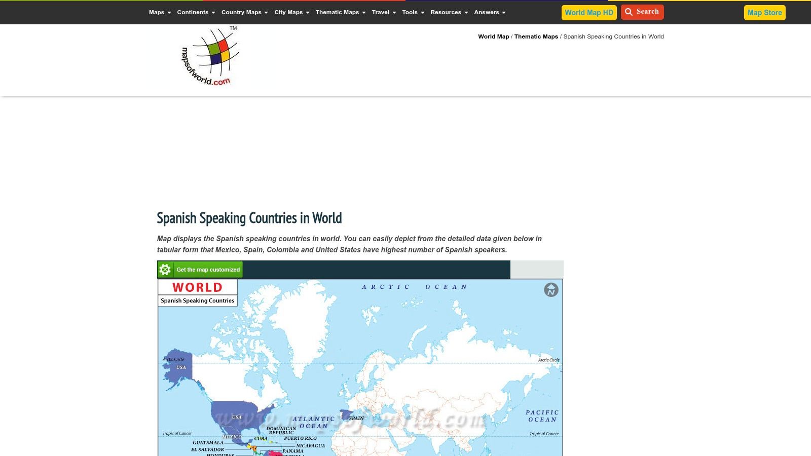
The platform stands out by offering custom map and GIS services. If the provided static map doesn't meet specific project needs, such as for a textbook or a detailed classroom poster, users can commission a tailored version. This service transforms a simple reference site into a potential source for high-quality, project-specific cartographic materials, bridging the gap between free online resources and professional design.
Key Features & Use Cases
| Feature | Best Use Case |
|---|---|
| Thematic Reference Map | Quickly verifying the official list of Spanish-speaking nations. |
| Contextual Statistics | Gathering foundational demographic and geographic data for a report. |
| Custom Map Services | Commissioning a high-resolution map for a publication or school curriculum. |
Pros:
- A single, clear source to verify a reference map and official country list.
- Option to commission tailored maps for specific educational or publishing needs.
Cons:
- The main map content is static and not an interactive tool or game.
- Some datasets on the page may be dated and should be verified for academic use.
Website: https://www.mapsofworld.com/thematic-maps/spanish-speaking-countries.html
12-Tool Comparison: Interactive Maps for Spanish-Speaking Countries
| Tool | Core features | UX / Quality (★) | Value & Price (💰) | Target audience (👥) | Unique selling points (✨) |
|---|---|---|---|---|---|
| EarthChasers 🏆 | Photorealistic 3D exploration, Daily Hunt, leaderboards, pro mapping tools (Elevation, LOS, ZIP) | ★★★★★ | 💰 Free unlimited core; Pro tier available (pricing undisclosed) | 👥 Educators, students, geography fans, casual gamers | ✨ Google Maps Photorealistic 3D; gaming + professional tools; strong community |
| Scribble Maps | Browser-based drawing, layers, public gallery, embed/share | ★★★★ | 💰 Freemium; paid for advanced exports/collab | 👥 Teachers, presenters, community mappers | ✨ Easy annotation & embed; public map gallery |
| Seterra (GeoGuessr) | Geography quizzes: pin/type modes; printable worksheets | ★★★★ | 💰 Free basics; some features require login/upgrade | 👥 Classrooms, self-study learners, quiz fans | ✨ Purpose-built activities; printable practice materials |
| MapChart | Click-to-color maps; legend maker; high-res PNG/SVG export | ★★★★ | 💰 Mostly free; optional donations/premium export | 👥 Teachers, presenters, designers | ✨ Fast color-coded maps with clean, print-ready exports |
| Didactalia Interactive Maps | Interactive exercises, multilingual, GeoJSON downloads | ★★★ | 💰 Free content; may include ads | 👥 Bilingual classrooms, practice-focused teachers | ✨ Instant feedback exercises; multilingual support |
| Rockalingua | Spanish-language map games; graded difficulty for kids | ★★★ | 💰 Subscription for full catalog | 👥 Young learners, Spanish classrooms | ✨ Language + geography integration; kid-friendly UI |
| Wordwall | Template-driven drills (labeling, matching, quizzes) | ★★★★ | 💰 Freemium; subscription for full templates | 👥 K–12 teachers, quick assessments | ✨ Rapid setup with many teacher-made activities |
| Teachers Pay Teachers (TPT) | Marketplace of downloadable/printable map activities | ★★★ | 💰 Pay-per-resource (affordable individual prices) | 👥 U.S. K–12 teachers, homeschoolers | ✨ Large catalog & reviews; instant downloads |
| Teacher's Discovery | Physical laminated/vinyl classroom maps and posters | ★★★ | 💰 Paid products; PO support for schools | 👥 Classroom teachers, schools needing durable posters | ✨ Durable, large-format classroom display maps |
| Twinkl | Downloadable maps with teacher notes and curriculum tags | ★★★★ | 💰 Subscription after trial | 👥 Teachers building lessons, curriculum-aligned planning | ✨ Curriculum-tagged resources and teacher notes |
| Etsy | Printable or shipped posters; varied art styles | ★★★ | 💰 One-time purchase per seller; digital or physical | 👥 Teachers, classroom decorators, decorators | ✨ Wide design variety; instant digital downloads |
| Maps of World | Reference maps, thematic stats, custom map services | ★★★ | 💰 Mostly free reference; paid custom maps | 👥 Publishers, schools needing custom maps | ✨ Thematic data + option to commission tailored maps |
Final Thoughts
Our journey through the digital atlas of the Spanish-speaking world has revealed a diverse and powerful collection of tools. From immersive 3D globes to gamified quizzes and customizable map creators, the resources available today offer unprecedented ways to engage with the geography, culture, and linguistic tapestry of these 20 unique nations. We've seen how a dynamic interactive map of Spanish speaking countries can be far more than a static image; it's a launchpad for discovery, a classroom aid, a trivia battlefield, and a personal exploration journal.
The key takeaway is that the "best" tool is entirely dependent on your objective. Your mission dictates your map. A geography enthusiast craving a rich, data-layered exploration will find a home in EarthChasers, while a teacher needing a quick, engaging quiz for their students might turn to Seterra or Wordwall. A trivia master preparing for their next competition could use MapChart to visualize and memorize capital cities and flags.
Choosing Your Ideal Mapping Tool
To select the right resource from this list, consider these guiding questions:
- What is my primary goal? Is it for deep learning and data visualization (EarthChasers, Scribble Maps), quick memorization and gamification (Seterra, Rockalingua), or creating custom educational materials (MapChart, Teachers Pay Teachers)?
- Who is the end-user? Are you a solo explorer, a parent teaching your child, or an educator managing a classroom? Tools like Didactalia are built for structured learning, while others offer more freeform exploration.
- What is my technical comfort level? Do I need a simple point-and-click interface, or am I comfortable working with layers, data imports, and embed codes? Answering this will help you decide between a user-friendly platform and a more feature-rich, complex one.
Ultimately, these tools are gateways. They provide the geographic framework, but the real learning happens when you dig deeper. To further enrich your cultural and linguistic understanding, you might explore authentic media from these regions. For instance, accessing documentaries or local news requires a different set of tools; a comprehensive guide on translating Spanish video to English can unlock a vast library of content, adding invaluable context to the locations you're exploring on the map.
This fusion of geographic exploration with cultural immersion is where true understanding is forged. An interactive map of Spanish speaking countries becomes not just a tool for learning where places are, but a portal for understanding who the people are. As you continue your explorations, remember to leverage the unique strengths of each platform to create a truly personalized and insightful journey across the globe.
Ready to move beyond flat maps and begin your 3D exploration of the world? EarthChasers offers the most immersive way to experience the geography of Spanish-speaking countries, with detailed terrain, customizable data layers, and powerful planning tools. Start your global adventure and see the world in a new dimension at EarthChasers today.