What is Spatial Thinking in Geography? Learn Its Significance
Discover what is spatial thinking in geography, its importance, and how it helps us understand the world's patterns and connections. Click to learn more!
When we talk about what is spatial thinking in geography, we're really talking about a fundamental human skill: the ability to understand and reason about the world in three dimensions. It’s the mental magic that lets us see not just where things are, but why they’re there and how they relate to everything else.
Think of it as your brain’s own internal, high-powered GPS. It's constantly working behind the scenes.
Seeing the World Through a Geographic Lens
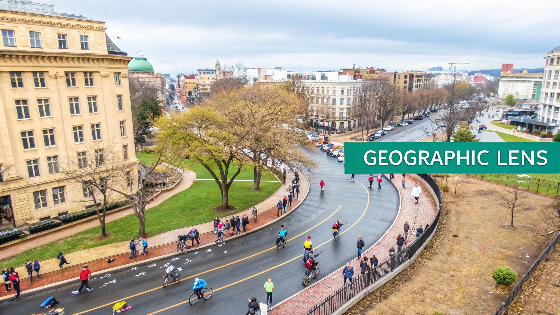
We use spatial thinking all the time, often without a second thought. Ever mapped out the quickest route through a crowded grocery store? Or rearranged your living room furniture to make the space feel bigger? That’s you, thinking spatially. It’s our natural way of seeing the world through a geographic lens.
But this skill goes way beyond simple navigation. It’s about spotting patterns, making connections, and analyzing how things are laid out in a specific area. It’s what allows us to start asking much deeper questions about the world around us.
The Garden Analogy
Imagine you’re planting a vegetable garden. You wouldn't just scatter seeds randomly and hope for the best, right? Instead, you’d be performing a pretty sophisticated spatial exercise without even realizing it.
- Proximity: You know to plant the sun-loving tomatoes where they’ll get the most light, while the lettuce gets a shadier spot. You're thinking about how proximity to a resource (sunlight) impacts success.
- Arrangement: You’d likely put the tall corn stalks in the back, so they don’t block the sun from the shorter green bean plants. That’s a deliberate arrangement designed to create a functional, thriving system.
- Density: You’d give the sprawling zucchini plants plenty of room to grow, preventing the kind of overcrowding that would stunt their growth. This is all about managing density for the best results.
That simple garden plan is a perfect little model of spatial thinking. You're weighing the location, distribution, and interaction of different elements within a defined space to get a specific result—a delicious harvest!
Spatial thinking is the "why of where." It connects abstract ideas like distance and direction to real-world outcomes, turning a simple dot on a map into a point of meaningful analysis.
From Backyards to the Global Stage
This exact same logic scales up, from a small garden plot to the entire planet. Geographers use spatial thinking to figure out why cities pop up near rivers, how a virus might spread through a population, or the most efficient places to build wind farms. It all boils down to that core ability to visualize space and the relationships within it.
The process often starts by simply identifying a location, which is where a coordinate system comes in. If you want a deeper look at the foundational grid that makes this all possible, you can explore what are latitude and longitude and see how they let us pinpoint any spot on Earth.
By mastering this way of seeing, you unlock a much deeper understanding of the patterns that shape our world, from your own neighborhood to entire continents. This is the very heart of geography and the first step toward solving our most complex global challenges.
Understanding the Three Pillars of Spatial Thinking
To really get a grip on spatial thinking in geography, we need to look under the hood. It’s not a single, magical skill but a powerful combination of three interconnected parts. Think of them as the foundation, the tools, and the strategy you use to make sense of the world around you.
By breaking it down, we can see how each piece of the puzzle contributes to a much deeper geographic understanding.
This infographic lays out the structure of spatial thinking, showing how its three core pillars branch out to form a complete skill set.
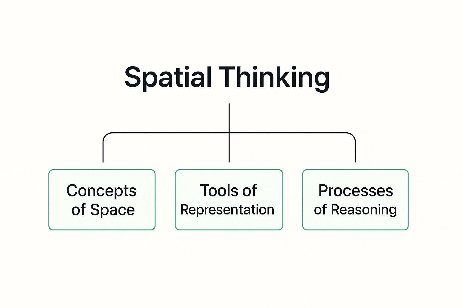
As you can see, you need to grasp the fundamental concepts before you can effectively use the tools and apply real reasoning. Each pillar builds directly on the last one.
Concepts of Space
The first pillar is all about the fundamental building blocks of geography—the Concepts of Space. This is the basic vocabulary we use to describe and measure our world. It’s about recognizing that every object, person, and event has a specific location and a relationship to everything else.
These concepts include things like:
- Location: Where something is. This can be absolute (like GPS coordinates) or relative ("it's next to the post office").
- Distance: How far apart two things are, whether it’s a straight line or the actual path you’d take.
- Direction: The orientation of something in space—north, south, east, west.
- Density: The concentration of something in an area, like the number of coffee shops per square mile.
- Pattern: How things are arranged, whether they're clustered together, spread out, or in a line.
You use these concepts instinctively. Just think about navigating a supermarket. You automatically process the location of the dairy aisle, its distance from the entrance, and the linear pattern of the aisles to find what you need. This mental framework is the essential first step.
Tools of Representation
Once you have the concepts down, you need a way to actually see and analyze them. That brings us to the second pillar: the Tools of Representation. These are the instruments that let us visualize spatial information and bring abstract data to life. They turn the concepts of space into something tangible we can work with.
For centuries, the map was the go-to tool. But today, our toolkit is way bigger. It includes everything from simple charts to complex digital models. Modern geographers and analysts lean heavily on Geographic Information Systems (GIS), which are powerful software platforms for capturing, storing, and displaying all kinds of geographic data.
A map isn't just a picture; it's a powerful argument. It tells a story about space, highlighting certain features while leaving others out, guiding your perception of a place.
These tools are crucial because they get our mental models out of our heads and onto a screen. They help us organize massive amounts of information and share our spatial insights with others. To see how these platforms work, you can learn more about what are Geographic Information Systems and their role in modern analysis.
Processes of Reasoning
The final and most active pillar is the Processes of Reasoning. This is where you put the concepts and tools into action. It’s the "thinking" part of spatial thinking—the cognitive skills we use to ask questions, spot trends, make predictions, and solve real-world problems.
This is what separates simply knowing where something is from understanding why it actually matters.
Here are a few ways we use spatial reasoning every day:
- Comparing: Looking at two different maps to see how a city has grown over 50 years.
- Inferring: Noticing a cluster of restaurants in one part of town and inferring that it's a commercial district.
- Predicting: Using data on river flow and elevation to predict which areas are most at risk of flooding.
- Problem-solving: Planning the most efficient delivery route by analyzing traffic patterns and road networks.
For example, a public health official might use GIS (a tool) to map the density (a concept) of flu cases. By analyzing the map, they can use reasoning to identify a potential outbreak hotspot and decide where to send medical resources. This complete process—from concept to tool to action—is what spatial thinking is all about.
How Spatial Thinking Solves Real-World Problems
This is where spatial thinking stops being an abstract idea and becomes a powerful, real-world tool. It’s the engine that turns raw location data into smart decisions, helping us tackle some of the planet's biggest challenges.
This isn't just an academic skill—it's essential for the people actively shaping our communities and protecting our environment. From designing better cities to managing global health crises, understanding the "why of where" is how we build a safer, more sustainable future.
Let's look at how it works on the ground.
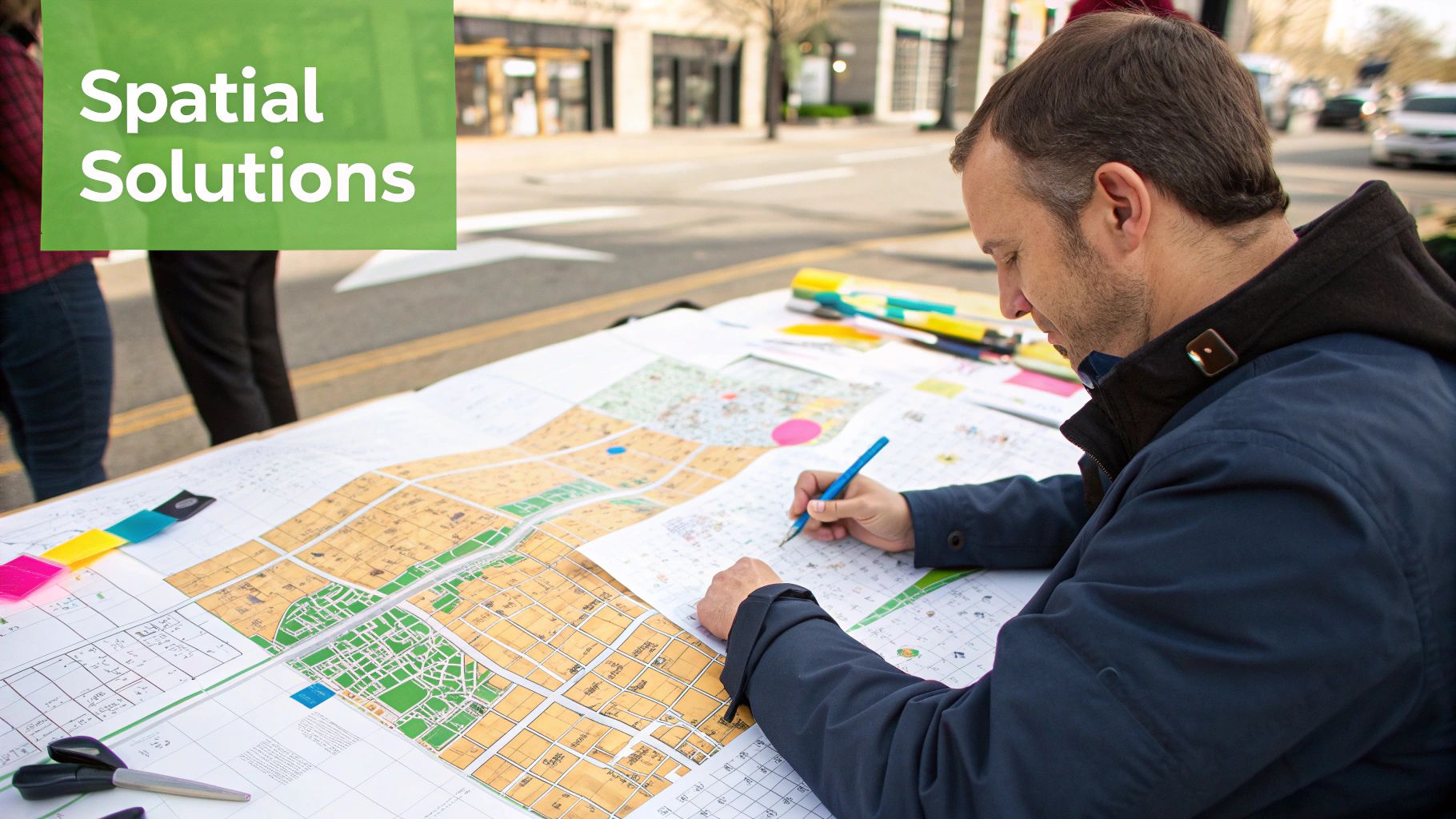
Designing Smarter and More Livable Cities
Urban planners live and breathe spatial thinking. They don’t see a city as just a random collection of buildings; they see a complex, living system where everything is connected. Their entire job revolves around using spatial analysis to answer questions that affect millions of lives every single day.
For example: Where’s the best spot for a new park to serve a community that desperately needs green space? What’s the most efficient route for a new subway line to cut down traffic and connect people to jobs?
By layering data—like population density, traffic flow, and existing infrastructure—planners can visualize these problems and test out solutions before a single shovel hits the dirt. This ensures that a city grows with purpose, not just by accident.
Protecting Our Planet and Its Biodiversity
In environmental science, spatial thinking is on the front lines of conservation. Scientists use everything from satellite images to GPS tracking to monitor how our planet is changing and protect its most vulnerable ecosystems. It’s how they see the bigger picture of our planet’s health.
Think about it. By mapping deforestation rates over time, conservationists can pinpoint hotspots where forests are most at risk and focus their efforts there. They can also map out wildlife corridors—the natural highways animals use to migrate—to make sure a new road doesn't cut off a critical path for survival.
Spatial analysis gives a voice to the environment. It translates complex ecological data into clear visual stories that demand attention and drive conservation policy, helping us protect critical habitats before they disappear.
Responding to Public Health Emergencies
Nowhere is the power of spatial thinking clearer than in public health. When a pandemic or disease outbreak hits, knowing where it's spreading is everything. Health officials use spatial data to map cases in real time, identify clusters, and predict where the illness might pop up next.
This isn't a new idea. Dr. John Snow famously did this back in 1854, mapping cholera cases in London to trace the outbreak to a single contaminated water pump. Today, the tools are far more advanced, but the principle is the same. Visualizing disease hotspots allows officials to make life-saving decisions about where to send medical supplies, set up testing centers, and concentrate public health campaigns.
This ability to spot patterns in space enables a targeted, rapid response that saves lives.
The link between geography and data has become a massive force in modern decision-making. In fact, nearly 80% of all digital data today has a location component, and the global market for Geographic Information Systems (GIS) hit around $10.6 billion by 2022. To dig deeper, check out Fiveable's insightful study guide on these concepts. These applications prove that spatial thinking isn't just a skill—it’s a global necessity.
Recognizing Spatial Thinking in Your Everyday Life
You might not think of yourself as a geographer, but I’ve got news for you: you’re already an expert spatial thinker. It’s true. That same complex reasoning used by urban planners and cartographers is something you use every single day, often without even realizing it.
It’s a fundamental human skill, humming away in the background of your mind, helping you make sense of the world. It’s not just for academics with fancy mapping software; it’s for anyone who's ever given directions, squeezed into a parking spot, or found the fastest checkout line at the grocery store.
Your Brain is a Natural Navigator
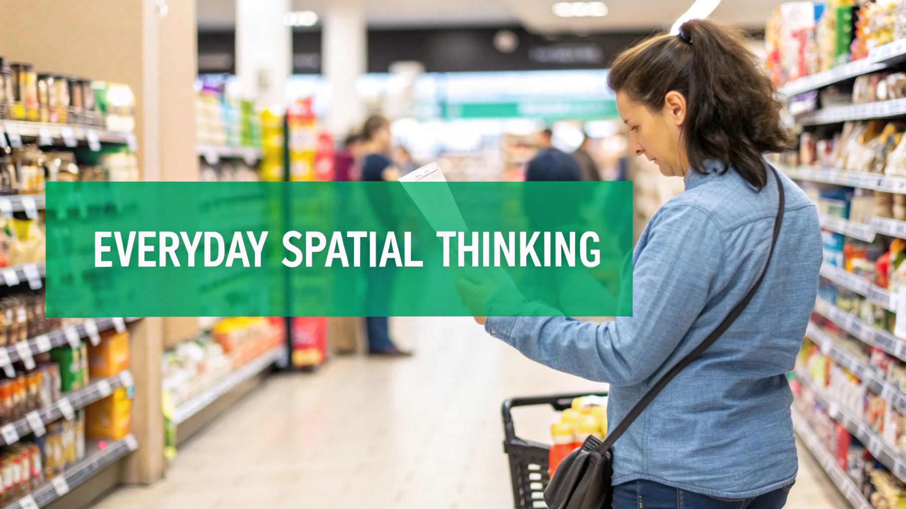
Think about your last trip to a busy supermarket with a long list. You didn't just wander aimlessly, did you? Of course not. In a split second, your brain performed a sophisticated spatial calculation.
You pictured the store's layout, mentally plotting the most efficient route to grab everything while minimizing backtracking. You probably even factored in the density of shoppers in the produce section and adjusted your path based on the proximity of the milk to the eggs. That, right there, is logistics and network analysis in action.
The same thing happens when you pick a seat in a movie theater. Your brain instantly chews through multiple spatial variables:
- Distance and Angle: How far is the screen? Is the angle too sharp? You just know where the sweet spot is.
- Proximity to Obstacles: Are you near an aisle for a quick escape? Or are you about to be trapped by a dozen people?
- Acoustic Space: You intuitively understand that the seats in the middle will probably have the best sound.
What feels like a simple choice is actually a rapid-fire spatial assessment. You’re weighing geographic factors to optimize your experience within a defined space.
Making Sense of Spatial Information
Beyond navigating your immediate surroundings, you use spatial thinking to interpret information constantly. The perfect example is the daily weather map. When the meteorologist shows that swirling radar image, you aren't just seeing colorful blobs.
You’re processing spatial data to make real-world decisions. You see a storm system moving from west to east and instantly understand its direction and trajectory. You look at its size and the pattern of its movement to guess when it might hit your town. And based on that quick geographic analysis, you decide whether to grab an umbrella or call off your barbecue.
Every time you interpret a map, arrange furniture in a room, or even follow a recipe in the kitchen, you are engaging in a spatial dialogue with your environment. You are actively organizing and making sense of the world based on the "why of where."
This ability to turn visual, location-based information into actionable knowledge is the heart of what is spatial thinking in geography.
From the strategic gameplay in EarthChasers—where you navigate a 3D globe to pinpoint landmarks—to the simple act of parallel parking your car, your life is filled with these little geographic puzzles. Once you start recognizing them, you'll see this isn't a new skill to learn, but an innate one you can consciously sharpen.
Actionable Ways to Develop Your Spatial Skills
Knowing what spatial thinking is is one thing. Actually getting better at it is another entirely. But here’s the great news: it’s not some fixed trait you’re born with. Think of it like a muscle—the more you use it, the stronger it gets. The trick is to shift from just passively looking at the world to actively engaging with its spatial patterns.
You can start strengthening this skill right now with some simple, even fun, activities. You don’t need any fancy software or a degree, just a little curiosity and a desire to see your surroundings in a new light.
Become an Active Map Explorer
In an era of turn-by-turn GPS, most of us have stopped really reading maps. We just follow the little blue line without ever getting a feel for the bigger picture. To build your spatial skills, you need to flip that habit on its head.
Instead of just looking for directions, pull up a map—digital or physical—and start asking questions. Look for the patterns. Why are the biggest parks all lined up along the river? Where are the clusters of schools, and what does that tell you about those neighborhoods? When you start actively questioning the layout, you train your brain to see relationships, not just routes.
A fantastic way to practice this is with more specialized maps. Learning how to read topographic maps, for instance, forces you to visualize a 3D landscape from a bunch of 2D lines. It's a killer workout for your spatial reasoning.
Action Tip: The next time you plan a trip, spend just 10 minutes exploring the map of where you're going. Find the main roads, the green spaces, and the commercial hubs. This simple exercise builds a mental model of the place before you even get there.
Embrace Your Inner Strategist with Games
You probably don't realize it, but many games are secret training grounds for spatial thinking. They create these perfect little worlds where you constantly have to analyze space, plan your moves, and predict what happens next based on where things are.
Strategy games are especially good for this. It doesn't matter if it's an old-school board game or a modern simulator—you're flexing those spatial muscles either way.
- Chess: This classic is basically a masterclass in spatial reasoning. You have to visualize the board multiple moves ahead, anticipate how your opponent will move across the grid, and understand how controlling certain squares can dominate the game.
- City-Building Simulations: Games like SimCity or Cities: Skylines make you the urban planner. You’re constantly thinking about road networks, zoning density, and where to put services—all of which are core geographic concepts.
- 3D Geography Games: And of course, games built specifically around geography are perfect. In EarthChasers, you navigate a 3D globe, using visual cues and spatial relationships to pinpoint locations. This directly hones the skills you need to interpret real-world landscapes.
These games make learning feel like play, all while sharpening your ability to think spatially.
Simple Real-World Exercises
You don't need a screen to practice this stuff. Some of the best exercises just involve paying a little more attention to the world around you.
Try this: Sketch a map of your neighborhood from memory. Don't worry about making it pretty. The whole point is to recall the layout of the streets, the location of key landmarks like parks or shops, and how they relate to each other. When you're done, pull up a real map and compare. This little exercise instantly shows you the gaps in your mental map and helps you build a stronger one.
Another great habit is to give someone directions without pulling out your phone. It forces you to translate that internal spatial knowledge into clear, logical instructions, which cements your own understanding of the area. These small, consistent efforts really add up, making spatial reasoning feel like second nature.
The Future of Geography and Spatial Thinking
Embedded content
As technology becomes more tangled up in our daily lives, understanding what is spatial thinking in geography is no longer just for cartographers and city planners. It's quickly becoming a fundamental skill for making sense of a world overflowing with data. The future isn't just about knowing where things are—it's about using location to predict, optimize, and build a smarter planet.
The next giant leap is happening where spatial analysis smashes into other game-changing technologies. This fusion is set to completely reshape how we tackle big problems, turning flat, boring maps into living, breathing tools that can see the future and guide our decisions with stunning accuracy.
The Rise of Geospatial AI
Artificial intelligence and machine learning are like rocket fuel for our spatial abilities. When you train an AI on massive geographic datasets—everything from satellite images to live traffic feeds—it starts to see patterns and connections a human brain could never spot. The possibilities are mind-boggling.
Imagine an AI system that can:
- Predict Natural Disasters: By spotting tiny changes in terrain, weather, and soil moisture, an AI could forecast a landslide or a flood with enough precision to give communities precious time to get out of the way.
- Optimize Global Supply Chains: Instead of just reacting to problems, AI can analyze shipping data, port traffic, and weather patterns to find the smartest routes before a bottleneck ever forms.
- Monitor Environmental Health: From catching illegal logging in the Amazon to tracking the melt of polar ice caps, an AI-powered system can give us a constant, automated health report for our planet.
This isn't some distant sci-fi dream. These systems are being built right now, fundamentally changing our power to manage the world on a global scale.
As our world generates more data, the ability to interpret it spatially becomes a critical advantage. Spatial thinking is the bridge between raw information and actionable insight, turning endless numbers into a clear story about our planet.
Smart Cities and the Internet of Things
The other huge frontier is the mashup of spatial thinking with the Internet of Things (IoT). Our cities are being filled with billions of tiny sensors—in our cars, streetlights, buildings, and water pipes. Every single one is collecting data that's tied to a specific place, creating a live, digital copy of our urban world.
This is where spatial thinking becomes the operating system for a smart city. By analyzing this firehose of real-time data, city managers can do things like:
- Manage Traffic Dynamically: Reroute cars in the moment to avoid gridlock.
- Conserve Energy: Automatically dim streetlights when no one is around.
- Improve Public Services: Send ambulances or fire trucks along the fastest routes based on live traffic data.
This constant feedback loop—where data is gathered, spatially analyzed, and used to make instant decisions—is the future of how we'll run our cities. As the world gets more complex, thinking spatially is moving from a niche skill to a survival tool for everyone. It's the key to unlocking a more efficient, sustainable, and responsive world.
Frequently Asked Questions About Spatial Thinking
Is Spatial Thinking the Same as Being Good with Directions?
Not exactly. Being good with directions is definitely a part of spatial thinking, but it’s just one piece of a much larger puzzle.
Spatial thinking goes deeper. It’s about spotting patterns on a map, understanding why things are located where they are, and interpreting visual data. It's the difference between blindly following GPS instructions and actually understanding the landscape you're moving through—recognizing why one route is faster or more scenic than another.
What Is the Difference Between Spatial Thinking and GIS?
This is a great question. The simplest way to think about it is that spatial thinking is the human skill, while Geographic Information Systems (GIS) are the tools we use to execute that skill.
It's like the difference between a chef's culinary creativity and the oven they use to cook. The chef has the vision and understanding (spatial thinking), and the oven is the powerful technology (GIS) that brings that vision to life on a massive scale.
In short, spatial thinking is the mind's strategy, and GIS is the technology that executes it. This distinction is key to understanding what spatial thinking in geography truly means.
How Can I Encourage Spatial Thinking in Children?
The best way is through everyday play and curiosity. You don't need fancy software to build a foundation for strong spatial skills.
Activities like building with LEGOs, piecing together jigsaw puzzles, or even just sketching a map of their bedroom or neighborhood are fantastic. Strategy board games and outdoor exploration also do wonders. And yes, certain video games can sharpen these abilities in a way that feels like pure fun.
Ready to put your spatial skills to the test in a fun, interactive way? Join the adventure with EarthChasers and explore the world like never before. Start your journey at https://earthchasers.com.